Loading trail…

Free — you'll pick up right here.
Watch this trail
Sign up to watch it — saving subscribes you to gate, closure and report changes.
Arizona
2.5 mi
Distance
18 ft
Gain
50 min
Time
Agency alerts are in effect for this area; weather is marginal
2 factors · 2 sources
Newest 20 h ago · oldest 15 d
caution: Agency alerts
7 active alerts in Coronado National Forest; most severe: Olson Cabin Closure 03-05-05-22-030
USFS15 d ago
caution: Weather
Rain, high 85°F / low 67°F, 100% precip — 60/100 for hike
OpenWeather20 h ago
Been out here in the last few days? One report keeps this current for everyone.
Why you'll love it
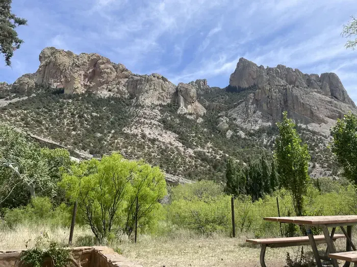
Sunny Flat
AI-suggested draft · review before you go
No permit or access details on file for this trail — check with the local land manager before you go.
Sunny Flat is a 2.5-mile out-and-back trail located in Arizona. With minimal elevation gain of just 18 feet, this is an accessible option for hikers of all experience levels seeking a relatively flat route. The trail's gentle terrain makes it suitable for families, casual walkers, and those looking for an easy day hike without significant climbing. The out-and-back format means you'll hike to a turnaround point and return along the same route, covering 2.5 miles total. This straightforward structure eliminates navigation concerns and allows hikers to set their own turnaround time based on fitness level and available time. Given the minimal elevation change and moderate distance, Sunny Flat typically requires 1-2 hours to complete at a leisurely pace. The flat profile makes this trail particularly good for early morning or evening hikes when you want to cover distance without strenuous exertion. Check local conditions before visiting, as Arizona trails can be affected by seasonal weather changes.
South Fork Trail #243
~2 min drive
A strenuous 27.56-mile out-and-back trail in Arizona for experienced hikers.
Hummingbird Spring Trail
~5 min drive
5.9 mi · Easy
Herb Martyr
~6 min drive
5.6 mi · Moderate
Mushroom Rock
~19 min drive
Easy out-and-back hike to a distinctive rock formation in Arizona.
Basin
~7 min drive
8.8 mi · Hard
Ash Spring
~6 min drive
2.0 mi · Easy
Burro Trail #240
~11 min drive
11 mi · Moderate
Big Balanced Rock
~19 min drive
Short out-and-back hike to a striking balanced rock formation.
Green House
~12 min drive
6.5 mi · Hard
Sentinel Peak Trail
~11 min drive
0.1 mi · Easy
Also worth it near here