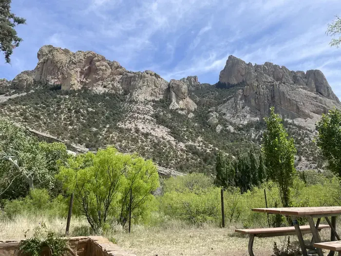
Loading trail…

Free — you'll pick up right here.
Watch this trail
Sign up to watch it — saving subscribes you to gate, closure and report changes.
Arizona
6.3 mi
Distance
758 ft
Gain
2h 29m
Time
We won't guess. Here is exactly what we do and don't know.
What we do know
Inside Coronado National Forest
2 managing-area boundaries mapped — agency alerts for them feed this page automatically.
Boundary data
What's missing
No access route mapped
We don't yet know which road reaches this trailhead, so we can't tell you if it's gated.
Nobody's filed a report here yet — be the first.
Why you'll love it
Devils Canyon
AI-suggested draft · review before you go
No permit or access details on file for this trail — check with the local land manager before you go.
Devils Canyon is a 6.3-mile out-and-back trail located in Arizona. The route features 758 feet of elevation gain, making it a moderate hike suitable for hikers with basic fitness levels. The trail takes you through the distinctive landscape of Arizona's canyon country. As an out-and-back route, you'll retrace your path on the return journey, covering approximately 12.6 miles total when accounting for both directions. This trail offers a solid day hike experience with manageable terrain and elevation change. The out-and-back format allows hikers to turn back at any point if needed, making it flexible for those with varying time constraints or fitness levels. Devils Canyon provides an opportunity to explore Arizona's natural geography and is accessible for hikers looking for a moderate-length outing with reasonable elevation gain.
Rucker Peak
~2 min drive
1.6 mi · Easy
North Bruno
~5 min drive
7.6 mi · Hard
Turtle Mountain
~5 min drive
4.6 mi · Moderate
Cub Canyon
~5 min drive
1.6 mi · Easy
John Long
~5 min drive
8.0 mi · Hard
Pine Gulch
~8 min drive
5.8 mi · Moderate
Turtle Mountain Trail #219
~10 min drive
3.5 mi · Easy
Price Shake
~12 min drive
6.9 mi · Hard
Red Rock Canyon Trail #223
~8 min drive
10 mi · Moderate
Crest Trail #270B
~11 min drive
5.8 mi · Easy
Also worth it near here