Loading trail…

Free — you'll pick up right here.
Watch this trail
Sign up to watch it — saving subscribes you to gate, closure and report changes.
West Virginia
2.8 mi
Distance
2,846 ft
Gain
1h 38m
Time
We won't guess. Here is exactly what we do and don't know.
What we do know
Inside New River Gorge National Park and Preserve
National Park unit boundary is mapped — agency alerts for it feed this page automatically.
Boundary data
What's missing
No access route mapped
We don't yet know which road reaches this trailhead, so we can't tell you if it's gated.
Nobody's filed a report here yet — be the first.
Why you'll love it
Southside Trail
AI-suggested draft · review before you go
No permit or access details on file for this trail — check with the local land manager before you go.
<p><em>Labeled (2) on the Cunard, Thurmond and Stone Cliff Area Trails map</em></p> <h4>Length</h4> <p>7.0 miles/11.27 km (One-way)</p> <h4>Difficulty</h4> <p>Easy</p> <h4>Trail type</h4> <p>Hiking and biking</p> <h4>Trail Description</h4> <p>This easy seven mile riverside trail provides great views of the New River and passes through several abandoned New River Gorge mining towns. Rush Run, Red Ash, and Brooklyn were all once bustling communities located along this abandoned railroad line. The first mile from Cunard River Access is open to motorized vehicles.</p> <h4>To reach the trailhead from Route 19</h4> <p>Follow Route 16 south through the town of Fayetteville. Take a left on Gateway Road (sign indicates Kaymoor and Cunard). Follow Gatewood Road for 4.6 miles and turn left at the sign for Cunard. Go 1.8 miles and turn left at both of the signs indicating Cunard River Access Road. Follow this road to the river access point, where parking is available. The first mile from the Cunard River Access is open to motorized vehicles. A parking area at Brooklyn marks the end of the maintained road.</p>
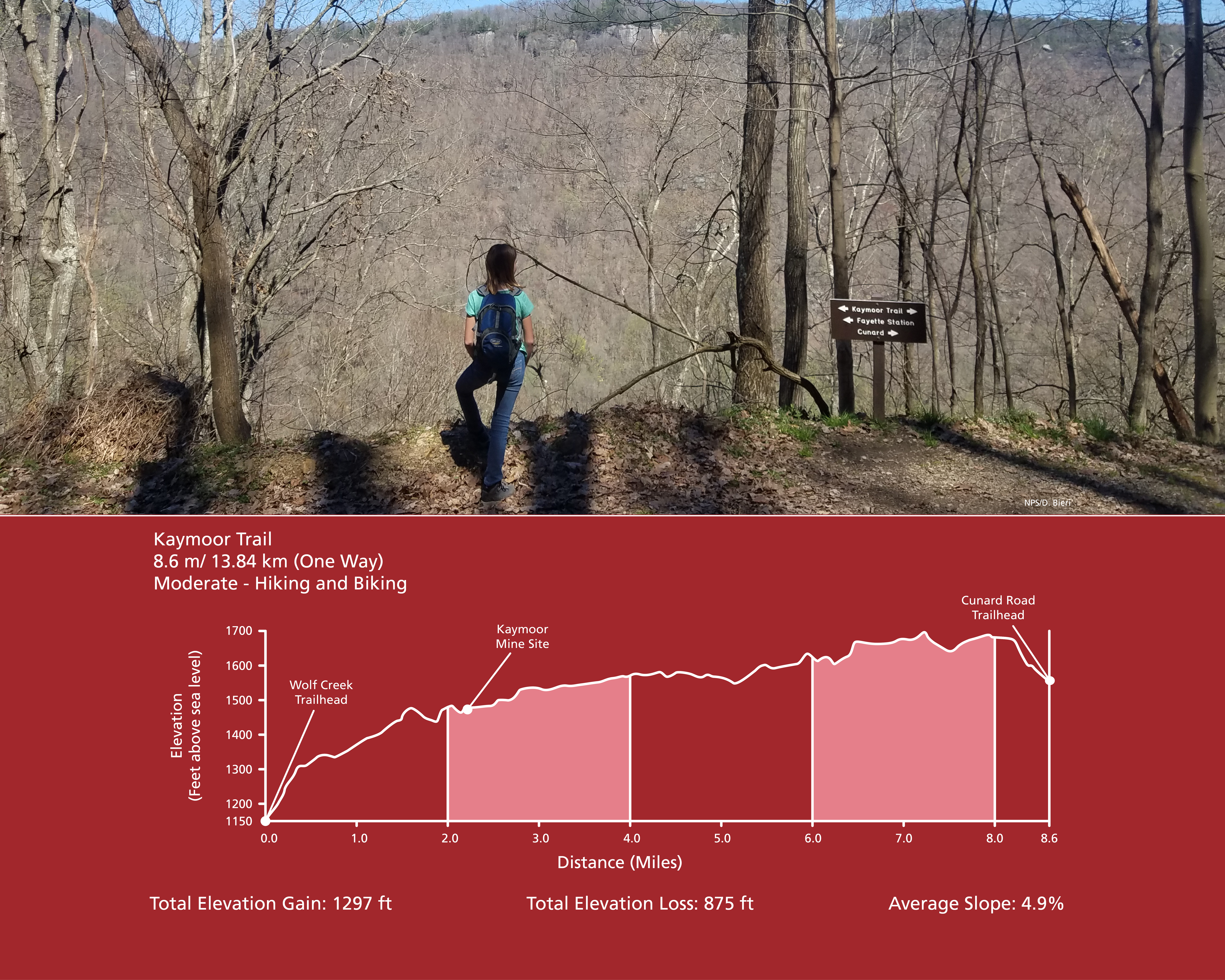
Kaymoor Trail
~2 min drive
<p><em>Labeled (8) on the Fayetteville - Lansing Area Trails map</em><br /> <br /> (Formerly part of the Kaymoor-Cunard Trail)</p> <h4><strong style="color: rgb(34, 34, 34); font-family: inherit; font-size: 1.25rem;">Length</strong></h4> <p>8.6 miles/13.84 km (One-way)</p> <h4…

Brooklyn Mine Trail
~2 min drive
<p><em>Labeled (1) on the Cunard, Thurmond and Stone Cliff Area Trails map</em></p> <h4>Length</h4> <p>2.7 miles/4.35 km (One-way)</p> <h4>Difficulty</h4> <p>Moderate</p> <h4><strong>Trail type</strong></h4> <p>Hiking, biking and equestrian</p> <h4>Total Elevation Gain</h4> <p…
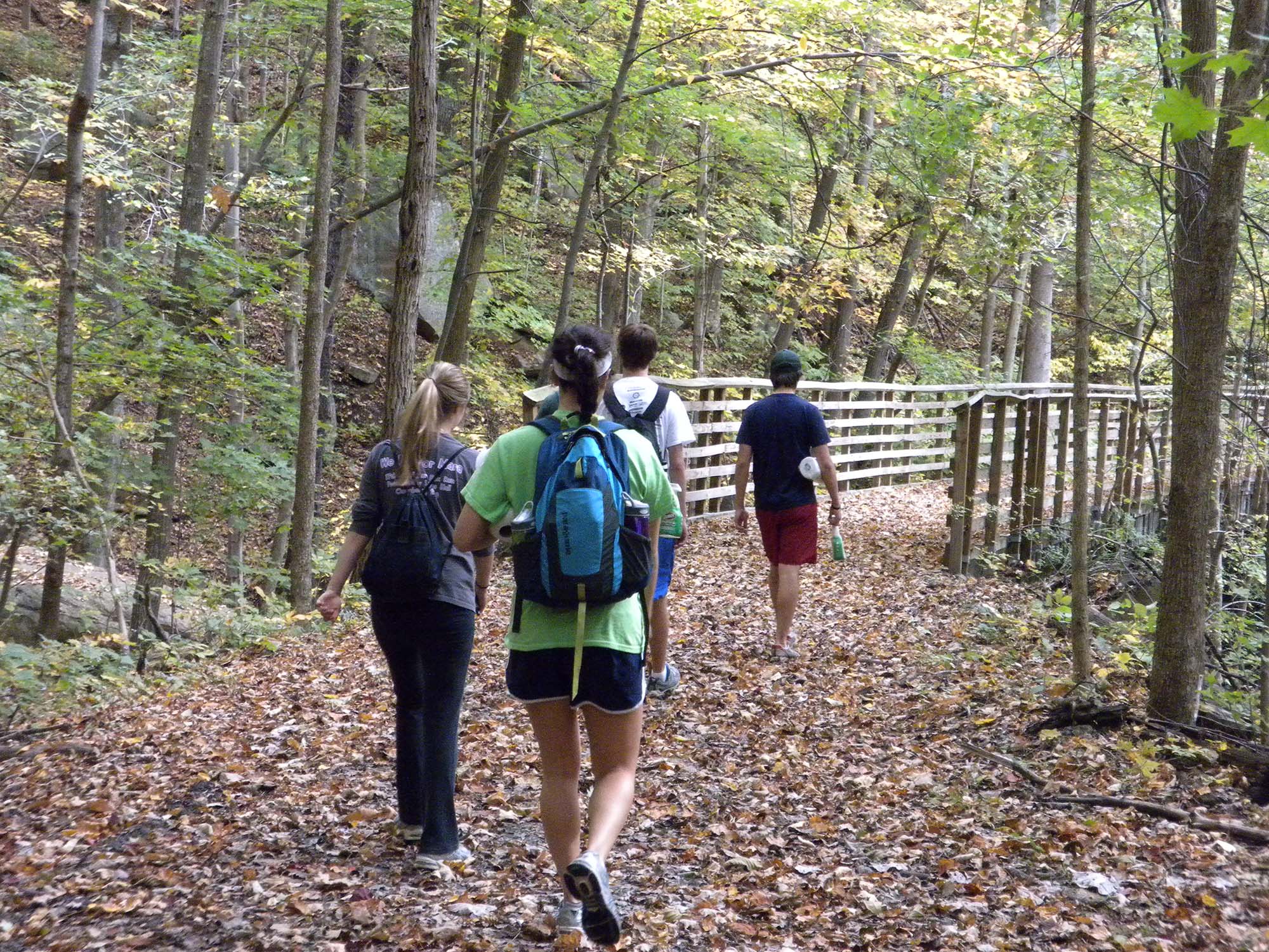
Keeneys Creek Rail Trail
~7 min drive
<p><em>Labeled (3) on the Nuttallburg Area Trails map</em></p> <h4><br /> Length</h4> <p>3.3 miles/5.31 km (One-way)</p> <h4>Difficulty</h4> <p>Easy</p> <h4>Trail type</h4> <p>Hiking and biking</p> <h4>Trail Description</h4> <p>This former rail line once connected the mines an…
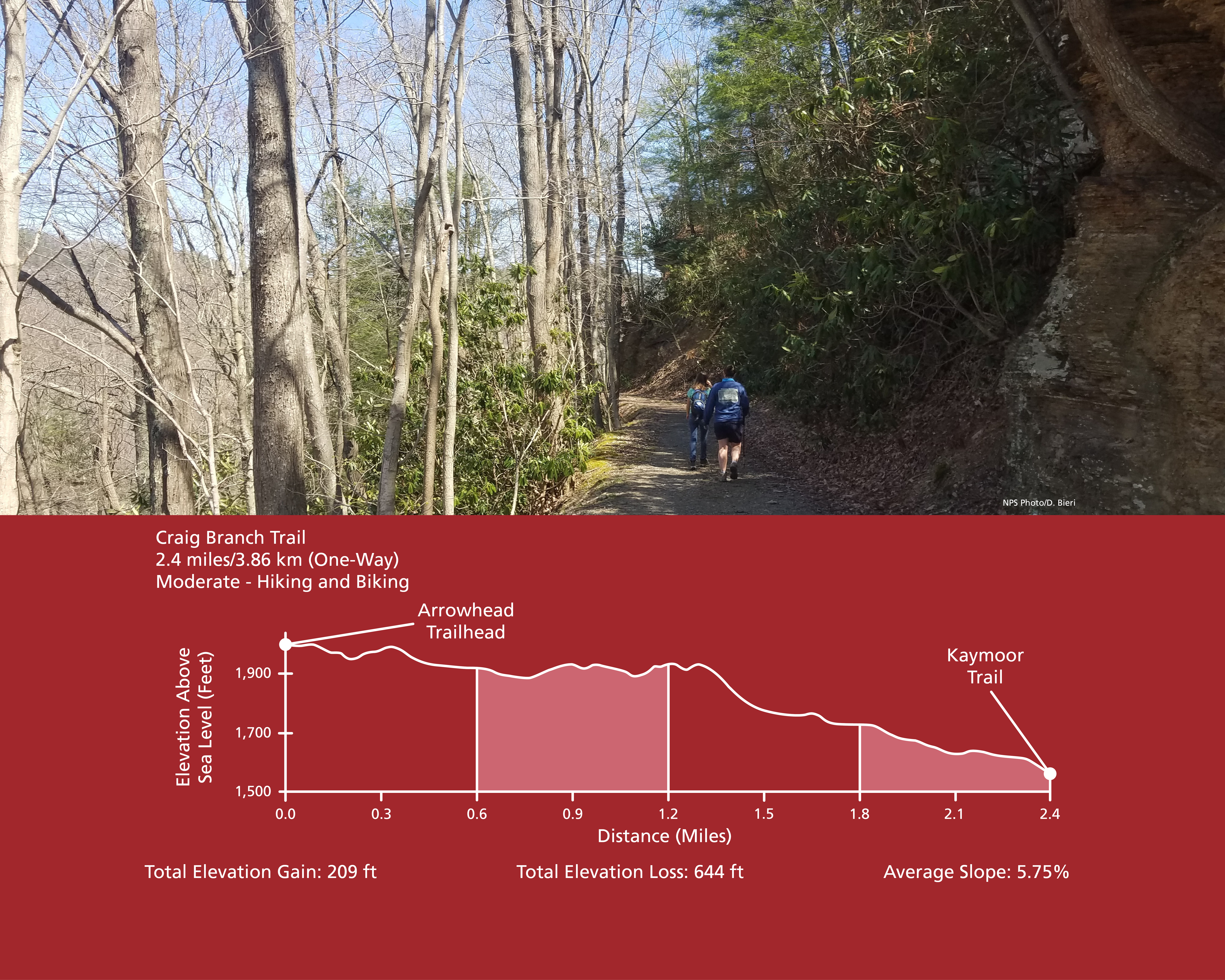
Craig Branch Trail
~8 min drive
<p><em>Labeled (10) on the Fayetteville - Lansing Area Trails map</em><br /> <br /> (Formerly part of the Kaymoor-Cunard Trail)</p> <h4><strong>Length</strong></h4> <p>2.4 miles/3.86 km (One-way)</p> <h4><strong>Difficulty</strong></h4> <p>Moderate</p> <h4><strong>Trail type</…
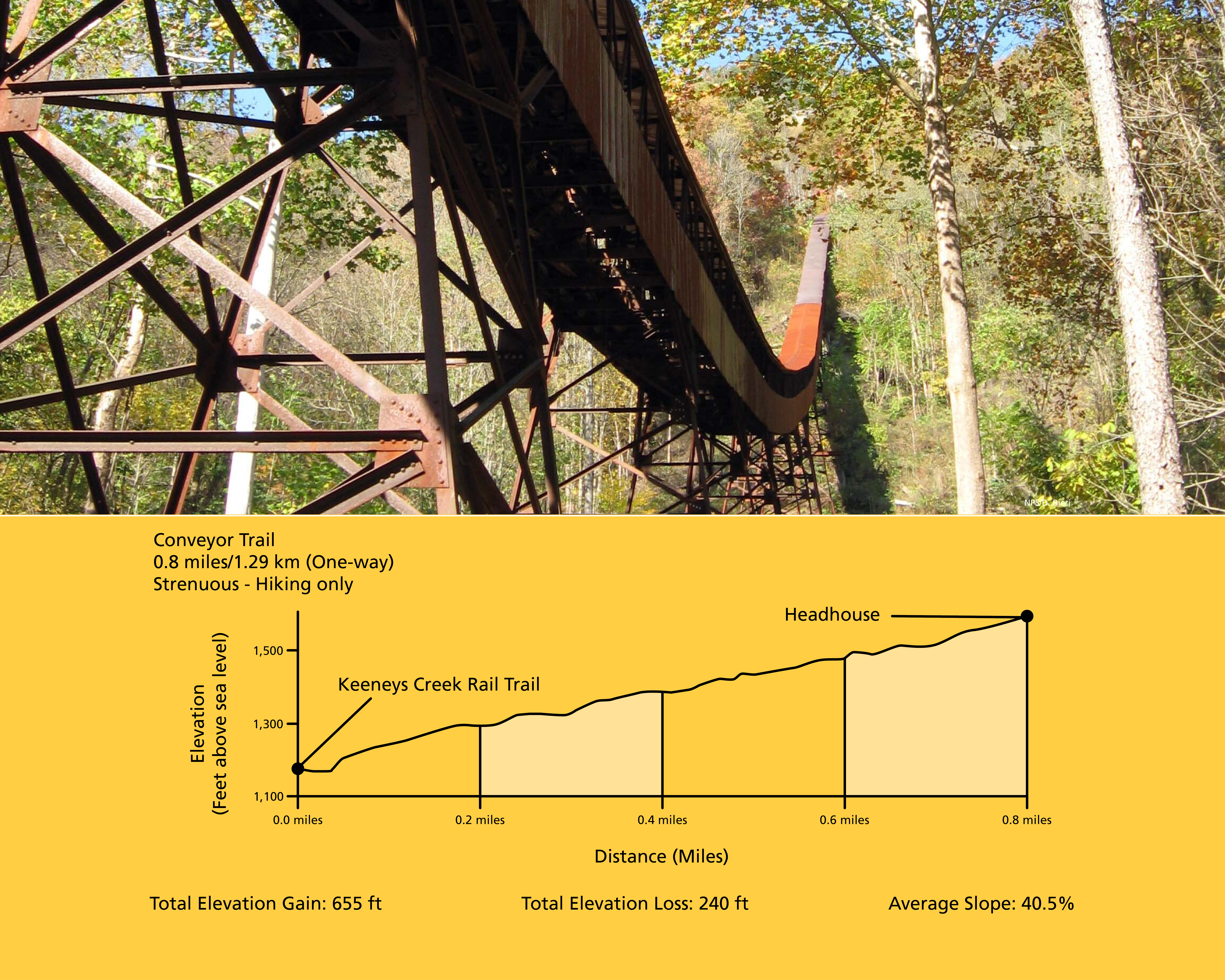
Conveyor Trail
~8 min drive
<p><em>Labeled (2) on the Nuttallburg Area Trails map</em></p> <h4>Length</h4> <p>0.8 miles/1.29 km (One-way)</p> <h4>Difficulty</h4> <p>Strenuous</p> <h4>Trail type</h4> <p>Hiking only</p> <h4>Total Elevation Gain</h4> <p>655 ft</p> <h4>Total Elevation Loss</h4> <p>240 ft</p>…
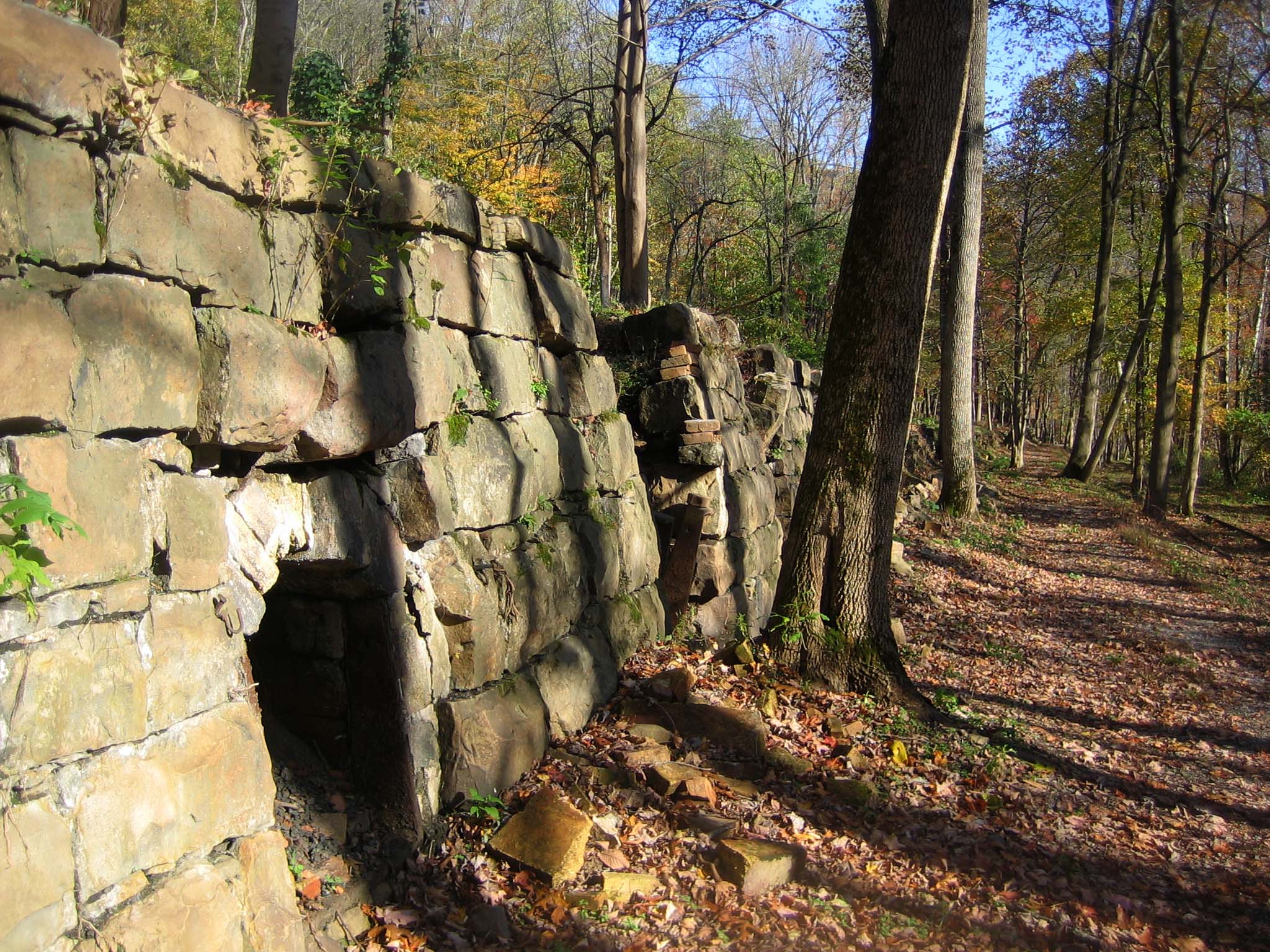
Tipple Trail
~8 min drive
<p><em>Labeled (6) on the Nuttallburg Area Trails map</em></p> <h4>Length</h4> <p>0.6 miles/0.96 km (One-way)</p> <h4>Difficulty</h4> <p>Easy</p> <h4>Trail type</h4> <p>Hiking and biking</p> <h4>Trail Description</h4> <p>This trail reveals both the industrial and community sid…

Kaymoor Miners Trail
~8 min drive
<p><em>Labeled (9) on the Fayetteville - Lansing Area Trails map</em></p> <h4><span style="color:#e74c3c;"><em>NPS crews are working to improve safety and sustainability of the upper section of the Kaymoor Miner's Trail. The upper portion of the trail will be closed from June…
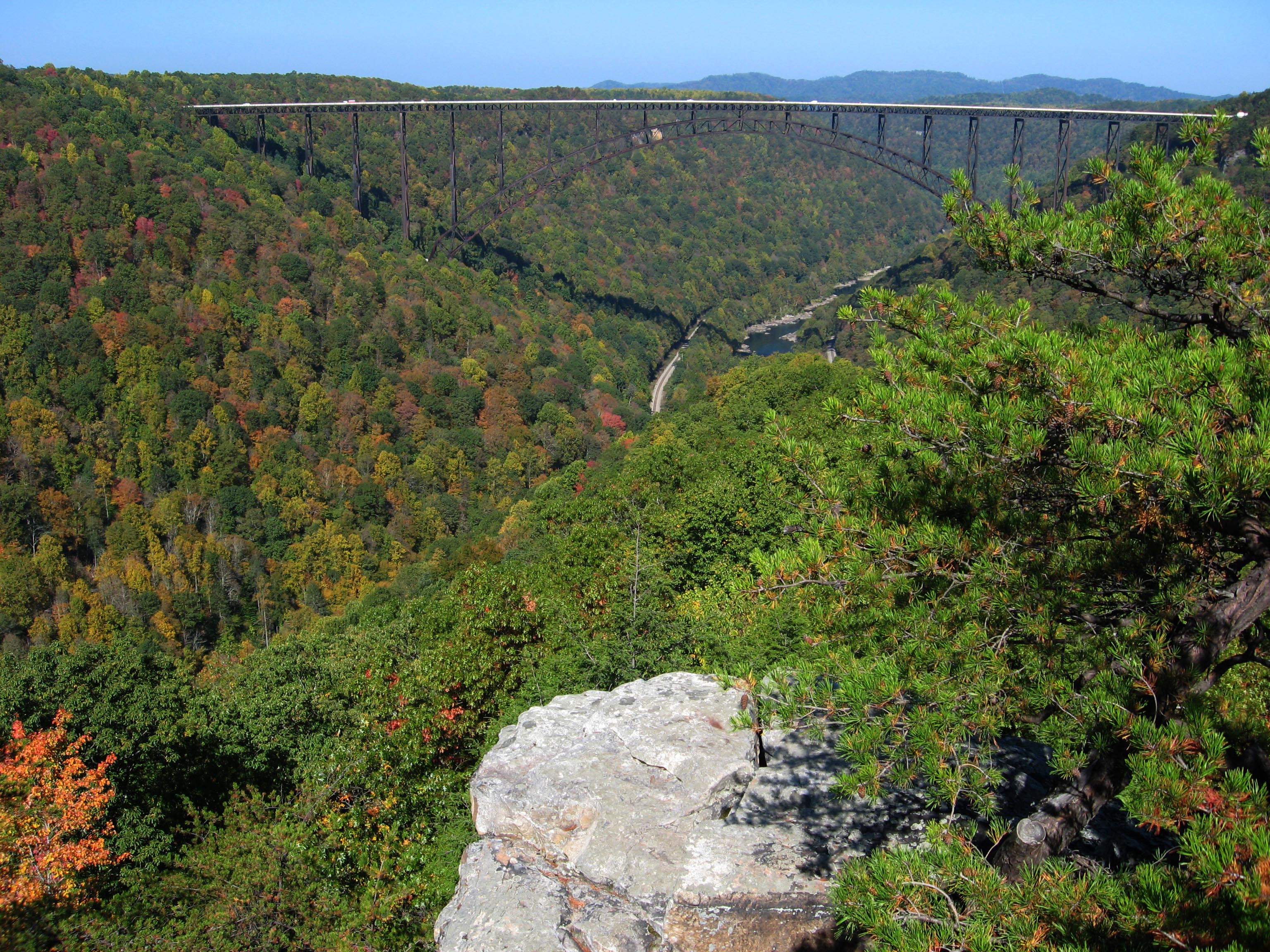
Long Point Trail
~8 min drive
<p><em>Labeled (12) on the Fayetteville - Lansing Area Trails map</em></p> <h4><strong>Length</strong></h4> <p>1.6 miles/1.29 km (One-way)</p> <h4><strong>Difficulty</strong></h4> <p>Moderate</p> <h4><strong>Trail type</strong></h4> <p>Hiking and biking </p> <h4>Trail Descript…

Headhouse Trail
~9 min drive
<p><em>Labeled (1) on the Nuttallburg Area Trails map</em></p> <h4>Length</h4> <p>0.7 miles/1.13 km (One-way)</p> <h4>Difficulty</h4> <p>Moderate</p> <h4>Trail type</h4> <p>Hiking and biking</p> <h4>Trail Description</h4> <p>This gravel trail (administrative road) leads to the…
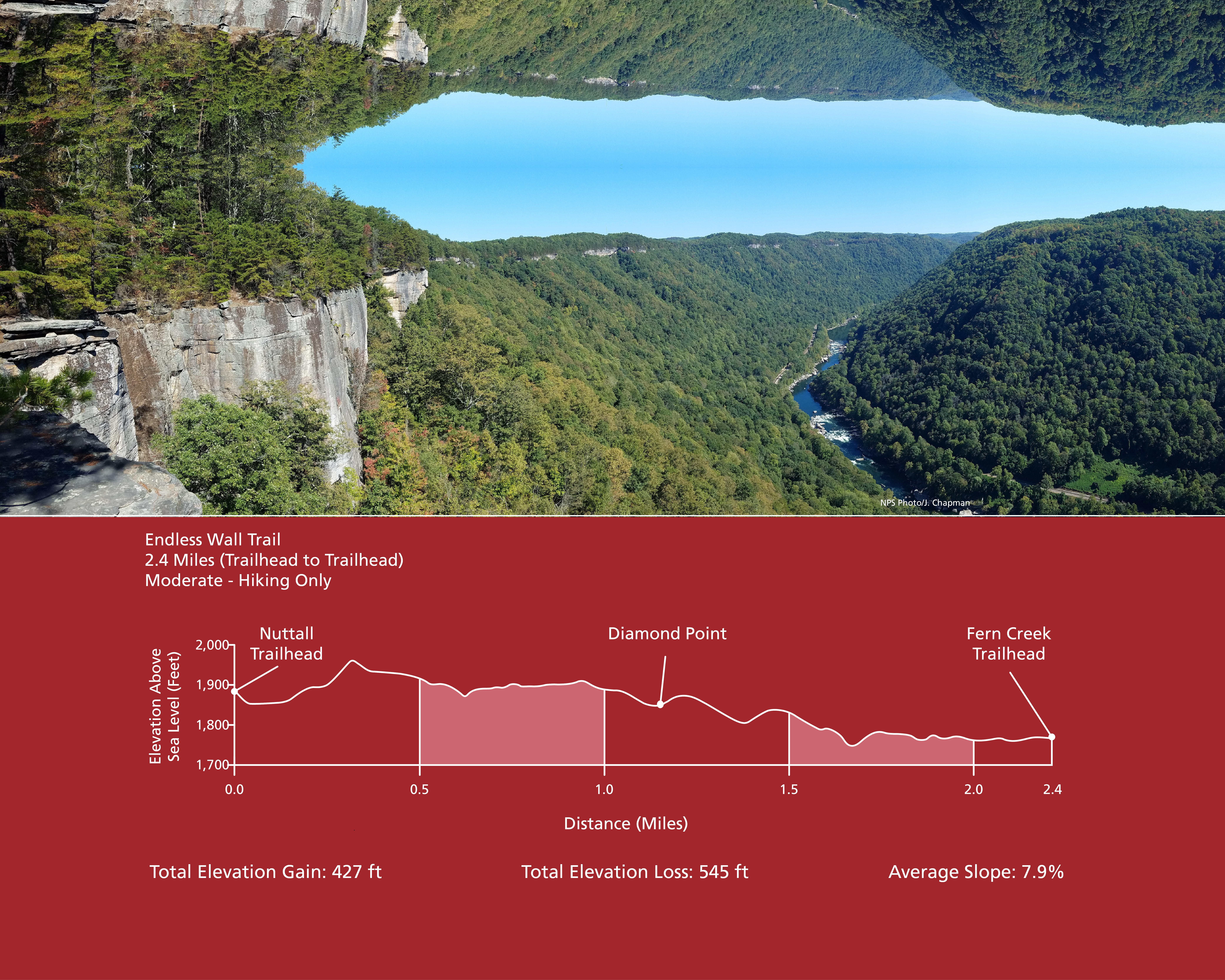
Endless Wall Trail
~10 min drive
<p><em>Labeled (3) on the Fayetteville - Lansing Area Trails map</em></p> <h4><strong>Length</strong></h4> <p>2.4 miles/3.86 km (One-way)</p> <h4><strong>Difficulty</strong></h4> <p>Easy to Moderate</p> <h4><strong>Trail type</strong></h4> <p>Hiking only</p> <h4>Total Elevatio…