Loading trail…

Free — you'll pick up right here.
Watch this trail
Sign up to watch it — saving subscribes you to gate, closure and report changes.
West Virginia
1.1 mi
Distance
511 ft
Gain
38 min
Time
We won't guess. Here is exactly what we do and don't know.
What we do know
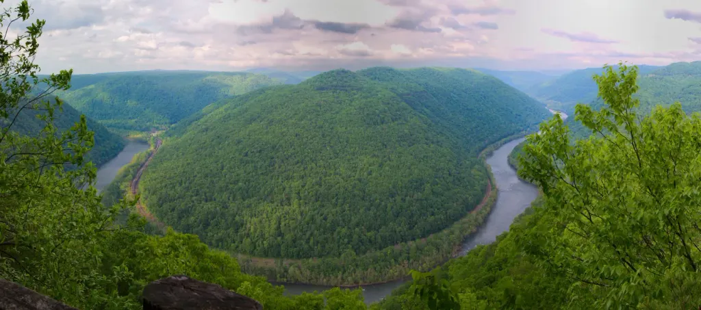
Inside New River Gorge National Park and Preserve
National Park unit boundary is mapped — agency alerts for it feed this page automatically.
Boundary data
What's missing
No access route mapped
We don't yet know which road reaches this trailhead, so we can't tell you if it's gated.
Nobody's filed a report here yet — be the first.
Why you'll love it
Long Point Trail
AI-suggested draft · review before you go
No permit or access details on file for this trail — check with the local land manager before you go.
<p><em>Labeled (12) on the Fayetteville - Lansing Area Trails map</em></p> <h4><strong>Length</strong></h4> <p>1.6 miles/1.29 km (One-way)</p> <h4><strong>Difficulty</strong></h4> <p>Moderate</p> <h4><strong>Trail type</strong></h4> <p>Hiking and biking </p> <h4>Trail Description</h4> <p>This trail traverses field and forest on the way to a rock outcrop (Long Point) with panoramic views of the gorge and New River Gorge Bridge. Most of this trail lazily descends through the forest, but it does include one steep section just before you arrive at the point. Mountain bikes are permitted except on the last 0.2 miles of the trail. There is a bicycle rack where bikes are not permitted. </p> <h4><span style="color:#e74c3c;">Note</span></h4> <p><span style="color:#e74c3c;">Use caution around the unprotected cliff edges located at Long Point.</span></p> <h4><strong>To reach trailhead</strong></h4> <p>From US 19, follow WV16 south through the town of Fayetteville. Turn left on Gatewood Road (sign indicates Kaymoor and Cunard). Follow Gatewood Road for 1.9 miles, and turn left on Newton Road. The trailhead parking area is 50 yards on the left.</p>
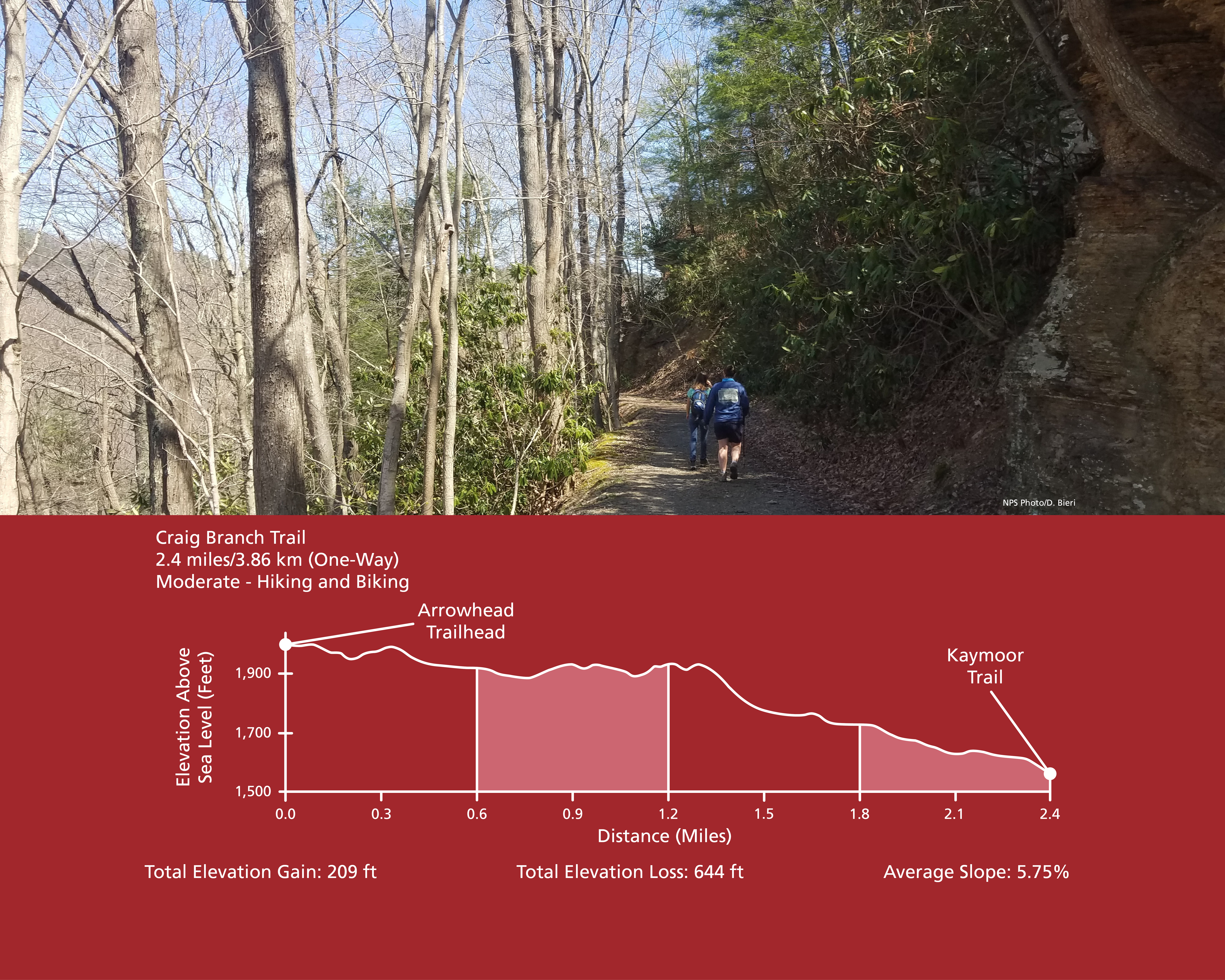
Craig Branch Trail
~1 min drive
<p><em>Labeled (10) on the Fayetteville - Lansing Area Trails map</em><br /> <br /> (Formerly part of the Kaymoor-Cunard Trail)</p> <h4><strong>Length</strong></h4> <p>2.4 miles/3.86 km (One-way)</p> <h4><strong>Difficulty</strong></h4> <p>Moderate</p> <h4><strong>Trail type</…

Kaymoor Miners Trail
~1 min drive
<p><em>Labeled (9) on the Fayetteville - Lansing Area Trails map</em></p> <h4><span style="color:#e74c3c;"><em>NPS crews are working to improve safety and sustainability of the upper section of the Kaymoor Miner's Trail. The upper portion of the trail will be closed from June…
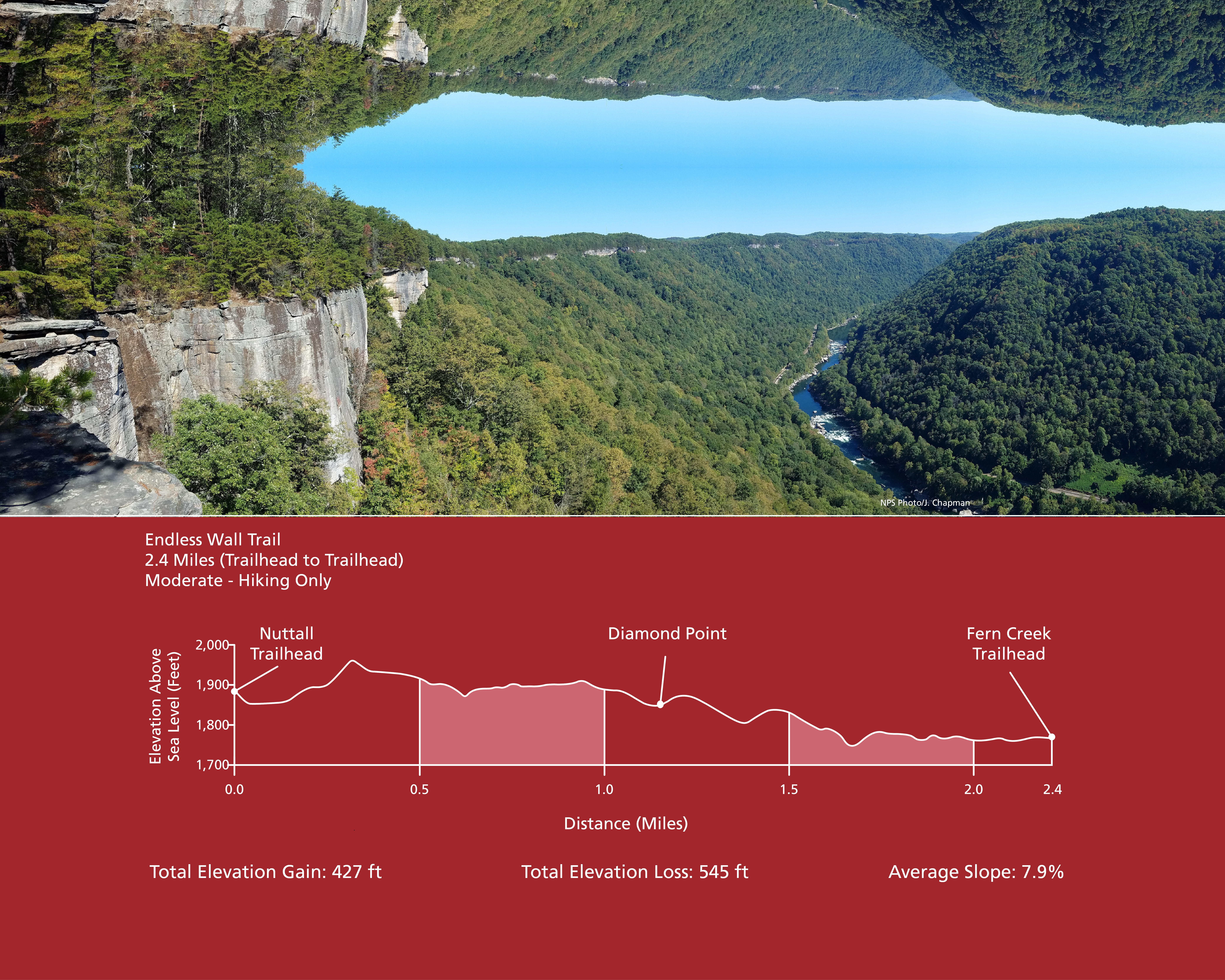
Endless Wall Trail
~3 min drive
<p><em>Labeled (3) on the Fayetteville - Lansing Area Trails map</em></p> <h4><strong>Length</strong></h4> <p>2.4 miles/3.86 km (One-way)</p> <h4><strong>Difficulty</strong></h4> <p>Easy to Moderate</p> <h4><strong>Trail type</strong></h4> <p>Hiking only</p> <h4>Total Elevatio…
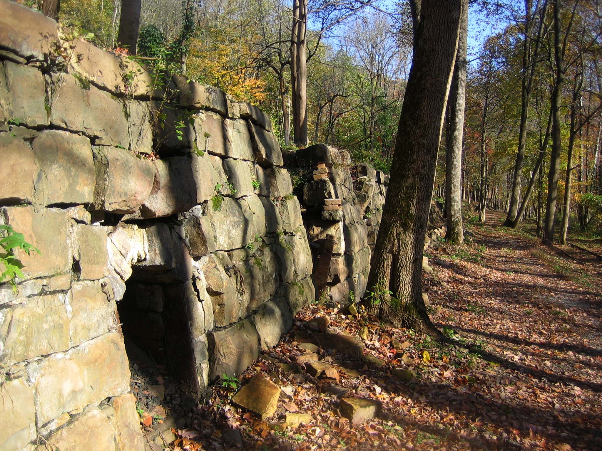
Tipple Trail
~4 min drive
<p><em>Labeled (6) on the Nuttallburg Area Trails map</em></p> <h4>Length</h4> <p>0.6 miles/0.96 km (One-way)</p> <h4>Difficulty</h4> <p>Easy</p> <h4>Trail type</h4> <p>Hiking and biking</p> <h4>Trail Description</h4> <p>This trail reveals both the industrial and community sid…
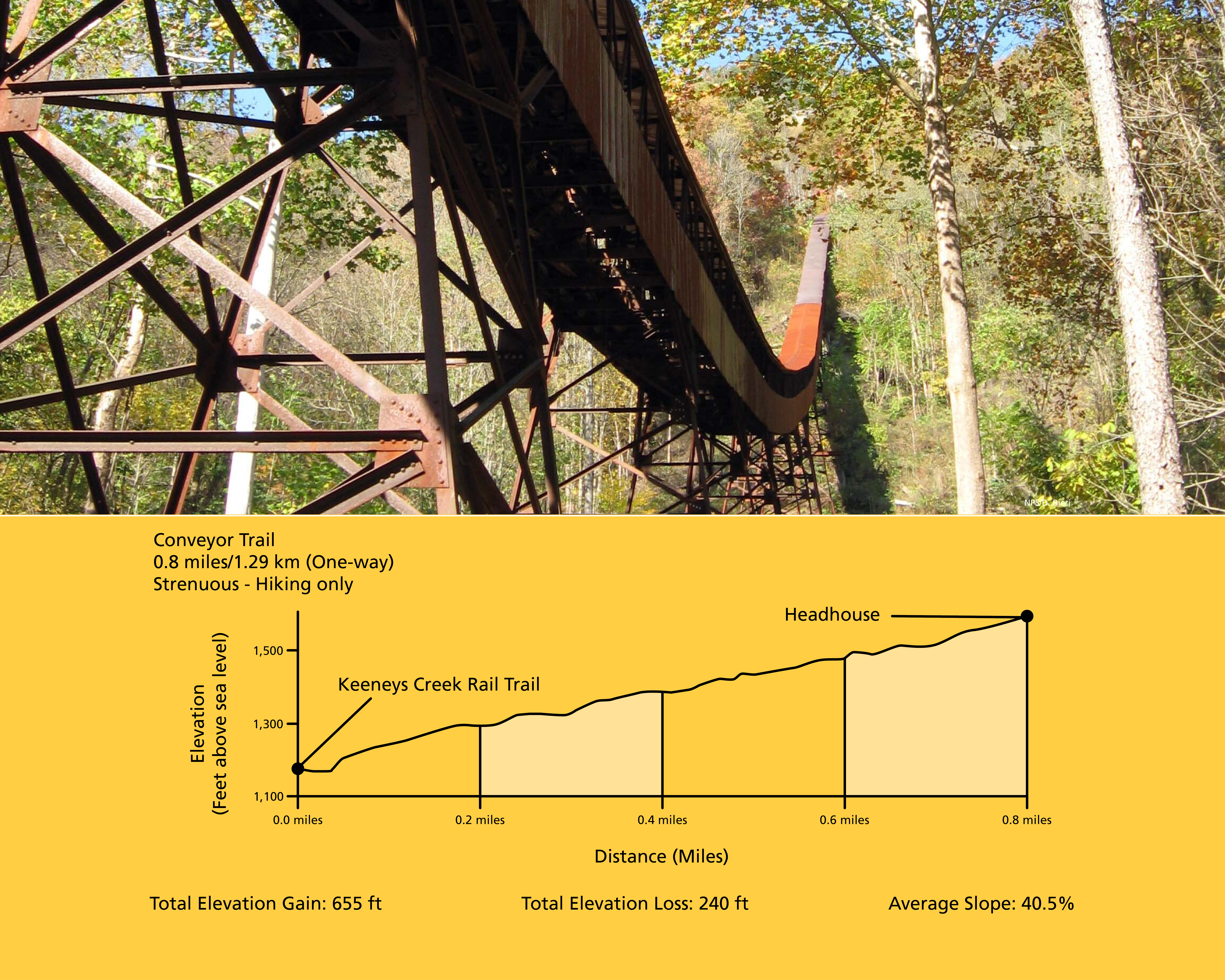
Conveyor Trail
~4 min drive
<p><em>Labeled (2) on the Nuttallburg Area Trails map</em></p> <h4>Length</h4> <p>0.8 miles/1.29 km (One-way)</p> <h4>Difficulty</h4> <p>Strenuous</p> <h4>Trail type</h4> <p>Hiking only</p> <h4>Total Elevation Gain</h4> <p>655 ft</p> <h4>Total Elevation Loss</h4> <p>240 ft</p>…
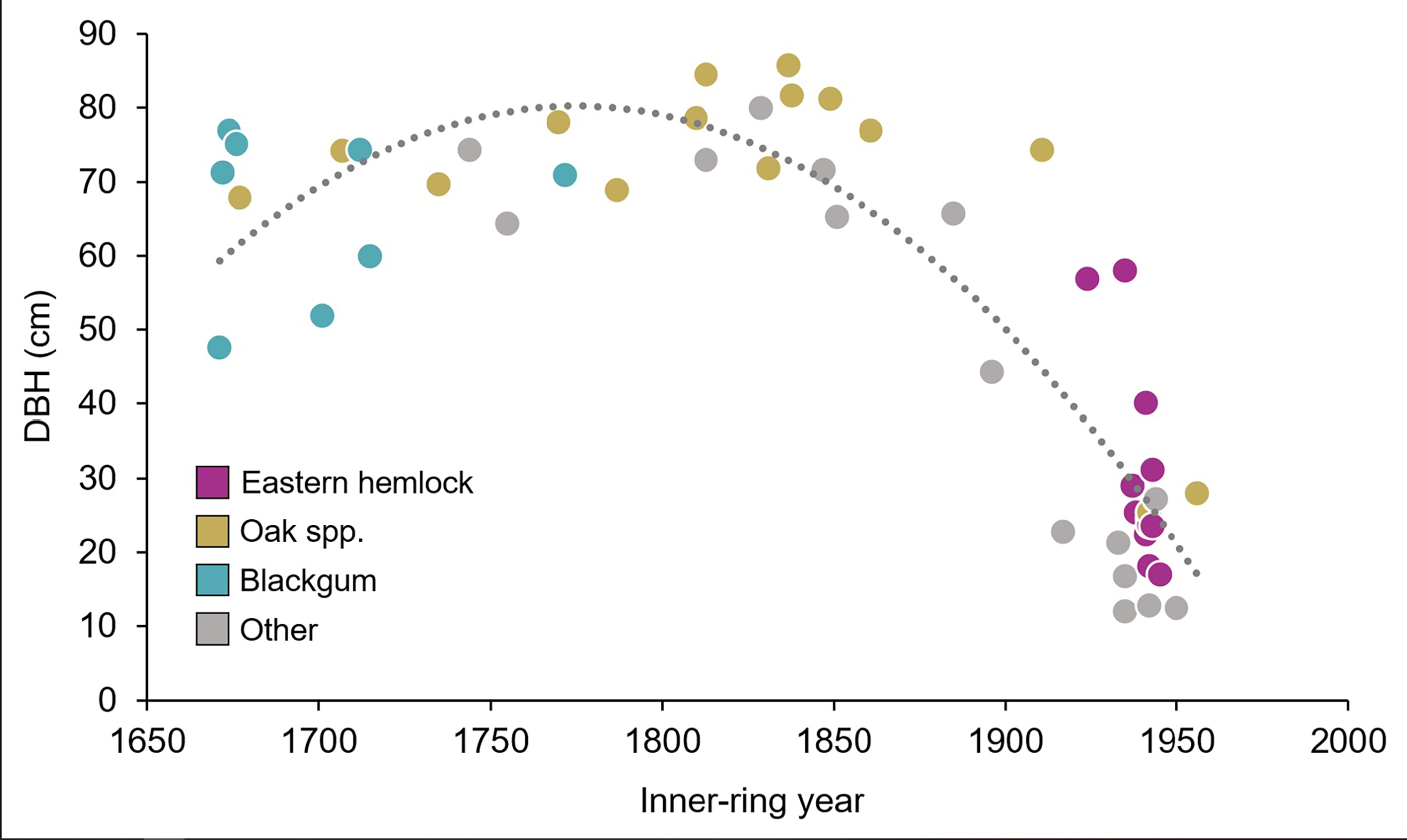
Burnwood Trail Stop 7: A Forest Giant
~4 min drive
<p><strong>Old-Growth Forest Hike Stop 7 - A Forest Giant</strong></p> <p>This American beech is the largest tree by diameter and volume along the trail. Unfortunately this tree couldn’t be dated due to being hollow, but despite its size it may not be as old as it appears. Som…
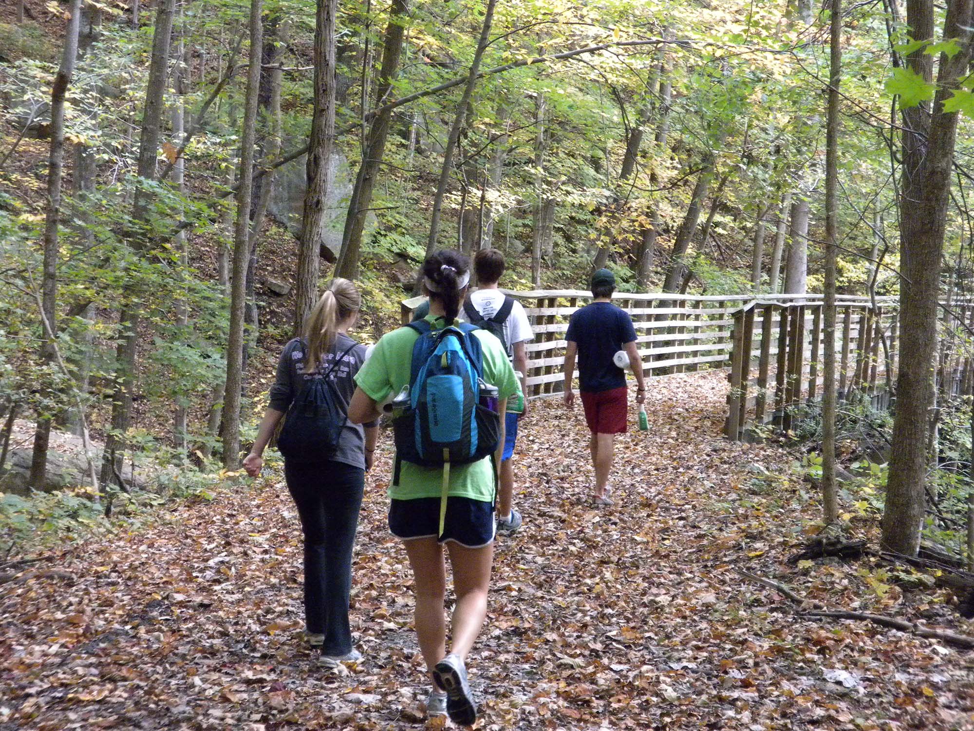
Keeneys Creek Rail Trail
~4 min drive
<p><em>Labeled (3) on the Nuttallburg Area Trails map</em></p> <h4><br /> Length</h4> <p>3.3 miles/5.31 km (One-way)</p> <h4>Difficulty</h4> <p>Easy</p> <h4>Trail type</h4> <p>Hiking and biking</p> <h4>Trail Description</h4> <p>This former rail line once connected the mines an…
Burnwood Trail Stop 8: Decomposition
~4 min drive
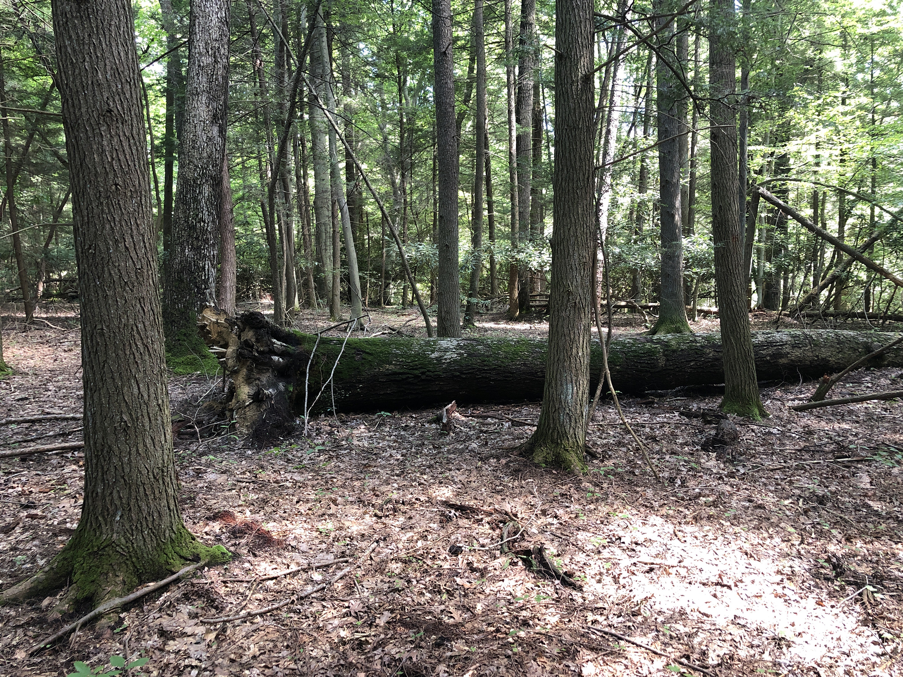
<p><strong>Old-Growth Forest Hike Stop 8 - Decomposition</strong></p> <p>There are many different components other than just big, old trees that make up an old-growth forest. Large fallen trees on the forest floor, also called coarse woody debris, are a key feature researchers…

Headhouse Trail
~5 min drive
<p><em>Labeled (1) on the Nuttallburg Area Trails map</em></p> <h4>Length</h4> <p>0.7 miles/1.13 km (One-way)</p> <h4>Difficulty</h4> <p>Moderate</p> <h4>Trail type</h4> <p>Hiking and biking</p> <h4>Trail Description</h4> <p>This gravel trail (administrative road) leads to the…
Kaymoor Trail
~6 min drive
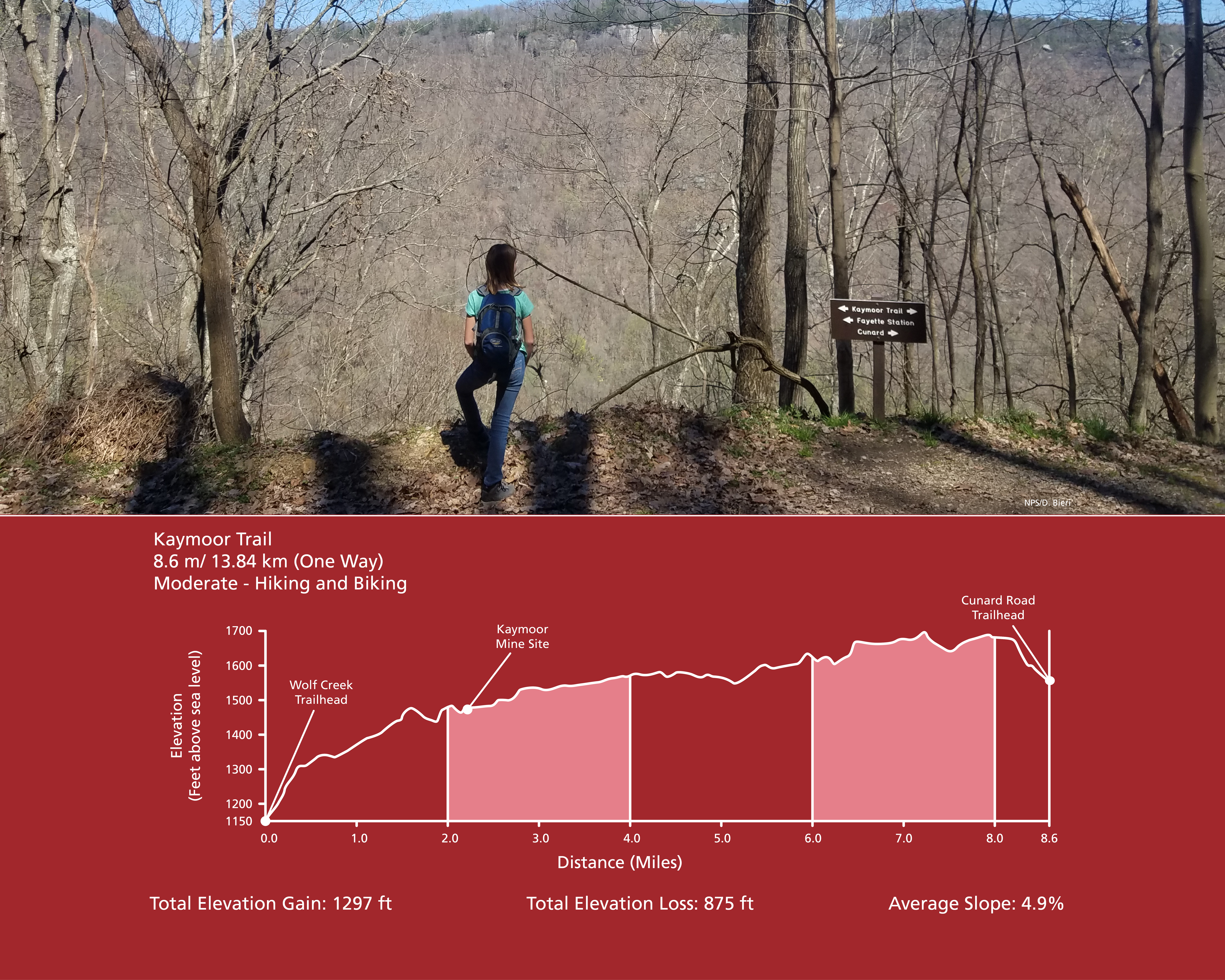
<p><em>Labeled (8) on the Fayetteville - Lansing Area Trails map</em><br /> <br /> (Formerly part of the Kaymoor-Cunard Trail)</p> <h4><strong style="color: rgb(34, 34, 34); font-family: inherit; font-size: 1.25rem;">Length</strong></h4> <p>8.6 miles/13.84 km (One-way)</p> <h4…