
Dixie's Lower Antelope Canyon Tours
Hiking business nearby (~8 mi away) — hasn't claimed their Roamze page yet
Spencer Trail
Free — you'll pick up right here.
Watch this trail
Sign up to watch it — saving subscribes you to gate, closure and report changes.
Arizona
Weather is good
1 factor · 1 source
Observed 13 h ago
clear: Weather
Clouds, high 88°F / low 68°F, 0% precip — 84/100 for hike
OpenWeather13 h ago
Been out here in the last few days? One report keeps this current for everyone.
Spencer Trail
AI-suggested draft · review before you go
No elevation data on file for this trail.
Rough mule trail for hauling Charles G. Spencer’s gold mining supplies. Built 1910 Spencer’s mining machinery needed fuel. As the rest of the miners hauled equipment to Lees Ferry, two men spend the fall of 1910 building a trail up this sheer cliff to a coalmine at Warm Creek Canyon, 30 miles away. Pack mules carried several loads of coal down the trail later that year. The trail climbs over 1500 feet in only a mile. If you choose to go up the Spencer Trail instead of continuing on the Historic River Trail, be prepared. Spencer Trail Information: Distance: 4.4 miles (7 km) round-trip Difficult A short but strenuous hike with amazing panoramic views of the Colorado River and the City of Page, this rocky climb up switchbacks ascends out of the canyon surrounding Lees Ferry to the top of the Paria Plateau. Avoid hiking during the hottest part of the day, there is no shade. Best times of year to hike are Spring and Fall. Bring plenty of water with you. Trailhead: Follow the Lees Ferry access road 5.8 miles (9.3 km) to the boat launch. A gravel parking lot at the end of the paved area will give you access to the start of the historic district. Divert from River Trail roughly .36 miles (.58 km) at posted junction. No overnight parking.
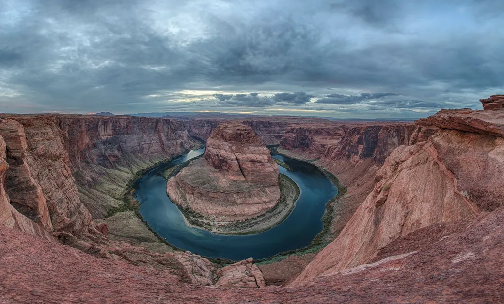
Horseshoe Bend on the Colorado River
~7 min drive
A social media darling, Horseshoe Bend has become one of the most recognized and visited places in Glen Canyon National Recreation Area. The parking lot and trailhead is located off US Highway 89, approximately 5 miles (8 km) south of the Carl Hayden Visitor Center. Changes a…
Spencer Trail
~1 min drive
3.9 mi · Easy
Rimview Trail
~13 min drive
10 mi · Hard
Navajo Route 6110
~36 min drive
A 1.56-mile moderate out-and-back doubletrack trail in Arizona that connects to the GWT - US 89 Connector system.
Historic District River Trail
~0 min drive
Throughout the 1800 and 1900s, Lees Ferry was backdrop to a mix of Westward expansion dreams and failed schemes. Because of its strategic location along the Colorado River, unlikely groups overlapped on these shores. Miners, traders, U.S. government scientist, Church elders,…
Cathedral Wash
~7 min drive
3.1 mi · Easy
Hayduke Trail #10
~46 min drive
Epic 148-mile remote backpacking route through Arizona wilderness.
Lees Ferry Paria Trail
~2 min drive
Easy riverside walk through red rock badlands near Lees Ferry.
Wildcat Tank Trail
~15 min drive
An easy 1.20-mile lollipop trail in Arizona ideal for casual hikers seeking a short desert walk.
Vermilion View Trail
~7 min drive
Scenic 4.5-mile out-and-back hike featuring vermilion rock formations.
Local operatorsoffering guided trips. You book directly with them — Roamze doesn’t take a cut.
Dixie's Lower Antelope Canyon Tours
Hiking business nearby (~8 mi away) — hasn't claimed their Roamze page yet
Antelope Slot Canyon Tours
Hiking business nearby (~8 mi away) — hasn't claimed their Roamze page yet
Tsé Bíghanílíní Tours
Hiking business nearby (~10 mi away) — hasn't claimed their Roamze page yet