Loading trail…

Free — you'll pick up right here.
Watch this trail
Sign up to watch it — saving subscribes you to gate, closure and report changes.
Arizona
8.9 mi
Distance
1,523 ft
Gain
3h 43m
Time
Agency alerts are in effect for this area; weather is marginal
2 factors · 2 sources
Newest 5 h ago · oldest 15 d
caution: Agency alerts
7 active alerts in Coronado National Forest; most severe: Olson Cabin Closure 03-05-05-22-030
USFS15 d ago
caution: Weather
Rain, high 65°F / low 65°F, 100% precip — 65/100 for hike
OpenWeather5 h ago
Been out here in the last few days? One report keeps this current for everyone.
Why you'll love it
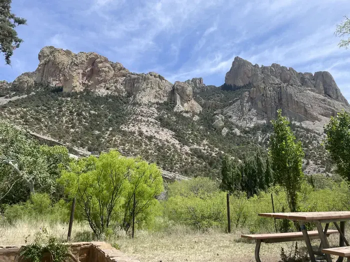
Crest Trail #270C
AI-suggested draft · review before you go
Crest Trail #270C is an 8.9-mile out-and-back trail located in Arizona and managed by the U.S. Forest Service. The route features 1,523 feet of elevation gain, making it a moderately challenging hike suitable for hikers with some experience. The out-and-back format allows you to turn around at any point, giving you flexibility to adjust your hike length based on your fitness level and available time. The steady elevation gain is distributed across the full distance, creating a gradual but consistent climb on the way out. This trail is maintained by the U.S. Forest Service, ensuring regular upkeep of the tread and signage. Before heading out, check current conditions with the managing agency, as trail status can vary seasonally. Plan for a full day outing if you intend to complete the entire 8.9-mile distance round trip. Bring adequate water and sun protection, as Arizona trails often have limited shade. Starting early in the day is recommended to ensure you have sufficient daylight for the return trip.
Sentinel Peak Trail
~1 min drive
0.1 mi · Easy
Price Canyon Trail #224
~1 min drive
11 mi · Moderate
Snowshed Trail #246
~3 min drive
17 mi · Hard
Jones Ridge Trail #365
~2 min drive
2.8 mi · Easy
Horseshoe Ridge Trail #282
~2 min drive
7.2 mi · Moderate
Green House
~6 min drive
6.5 mi · Hard
Baker Canyon Trail #225
~2 min drive
5.4 mi · Easy
Rucker Trail #222
~3 min drive
9.4 mi · Moderate
Price Shake
~7 min drive
6.9 mi · Hard
Ojo Agua Fria
~5 min drive
A 2-mile out-and-back singletrack in Arizona that connects to the Crest Trail and Chiricahua Peak Bypass Trail.
Also worth it near here