

Up The Creek Campground
Hiking business nearby (~5 mi away) — hasn't claimed their Roamze page yet
Free — you'll pick up right here.
Watch this trail
Sign up to watch it — saving subscribes you to gate, closure and report changes.
Utah
283 ft
Gain
We won't guess. Here is exactly what we do and don't know.
What we do know
Inside Arches National Park
National Park unit boundary is mapped — agency alerts for it feed this page automatically.
Boundary data
What's missing
No access route mapped
We don't yet know which road reaches this trailhead, so we can't tell you if it's gated.
Nobody's filed a report here yet — be the first.
Why you'll love it
Park Avenue Viewpoint and Trail
AI-suggested draft · review before you go
No permit or access details on file for this trail — check with the local land manager before you go.
<p>A paved sidewalk leads to a viewpoint down a corridor of towering rock walls and curiously carved spires. Descend stairs to walk the trail among massive monoliths toward Courthouse Towers Viewpoint one mile away.</p> <ul role="list"> <li aria-setsize="-1" data-aria-level="4" data-aria-posinset="4" data-font="Symbol" data-leveltext="" data-listid="5" role="listitem"> <p paraeid="{40b1cba8-3deb-4ea9-a081-57209769ce2b}{6}" paraid="2128532118"><strong>Roundtrip Distance</strong>: 1.8 mi (3.2 km) </p> </li> </ul> <ul role="list"> <li aria-setsize="-1" data-aria-level="4" data-aria-posinset="1" data-font="Symbol" data-leveltext="" data-listid="5" role="listitem"> <p paraeid="{40b1cba8-3deb-4ea9-a081-57209769ce2b}{15}" paraid="9757270"><strong>Time</strong>: 1 hour </p> </li> <li aria-setsize="-1" data-aria-level="4" data-aria-posinset="2" data-font="Symbol" data-leveltext="" data-listid="5" role="listitem"> <p paraeid="{40b1cba8-3deb-4ea9-a081-57209769ce2b}{24}" paraid="1404676622"><strong>Elevation Change</strong>: 322 ft (98 m) </p> </li> <li aria-setsize="-1" data-aria-level="4" data-aria-posinset="3" data-font="Symbol" data-leveltext="" data-listid="5" role="listitem"> <p paraeid="{40b1cba8-3deb-4ea9-a081-57209769ce2b}{33}" paraid="1126593180"><strong>Difficulty</strong>: Moderate </p> </li> <li paraeid="{40b1cba8-3deb-4ea9-a081-57209769ce2b}{42}" paraid="956339717"><strong>Hike Description</strong>: The trail descends steeply into a spectacular canyon and continues to Courthouse Towers. For a roundtrip hike, retrace your steps along the trail rather than walking along the road. </li> <li paraeid="{40b1cba8-3deb-4ea9-a081-57209769ce2b}{42}" paraid="956339717"><strong>Trail Tip</strong>: To avoid the steep stairs, start at the north end.</li> <li aria-setsize="-1" data-aria-level="4" data-aria-posinset="5" data-font="Symbol" data-leveltext="" data-listid="5" role="listitem"> <p paraeid="{40b1cba8-3deb-4ea9-a081-57209769ce2b}{51}" paraid="1897164144"><strong>Accessibility</strong>: The paved walkway to the viewpoint is accessible to wheelchairs. Beyond, this trail has a long flight of stairs and requires some walking on sand and uneven surfaces. </p> </li> </ul> <ul role="list"> <li aria-setsize="-1" data-aria-level="4" data-aria-posinset="1" data-font="Symbol" data-leveltext="" data-listid="5" role="listitem"> <p paraeid="{40b1cba8-3deb-4ea9-a081-57209769ce2b}{60}" paraid="1264399004">Dogs are not allowed on this trail. Service animals are allowed in national parks. <a href="https://cms.nps.gov/planyourvisit/service-animals.htm">What is a service animal?</a> </p> </li> </ul> <p>Just 3.6 miles (5.8 km) after Arches National Park Visitor Center, this is many visitors' first scenic stop. At Park Avenue, you can gaze down a grand boulevard of rock and let your imagination loose. Previous visitors named some of the rock features here "Queen Nefertiti," "Queen Victoria," and "Sausage Rock" (also known as "The Corndog"). What names does your imagination suggest?</p> <p>Often overlooked, Park Avenue Arch is visible from the parking lot, suspended high up a rock wall on the right. Light is not visible through the arch from this angle.</p>
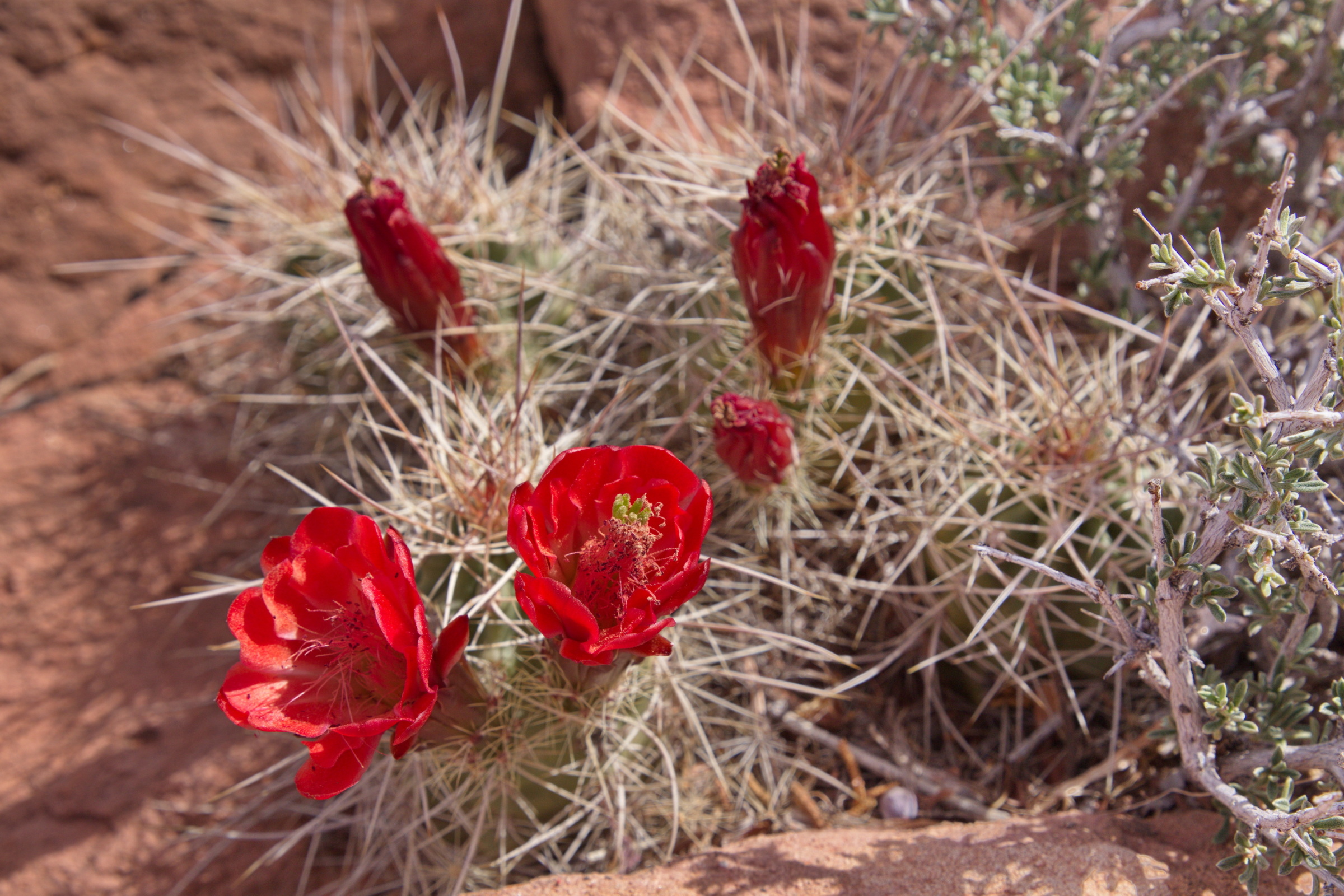
Arches Visitor Center Nature Trail
~2 min drive
<p>Walk a short path behind the visitor center to learn about native desert plants and their traditional uses.</p> <ul role="list"> <li aria-setsize="-1" data-aria-level="4" data-aria-posinset="1" data-font="Symbol" data-leveltext="" data-listid="5" role="listitem"> <p paraei…
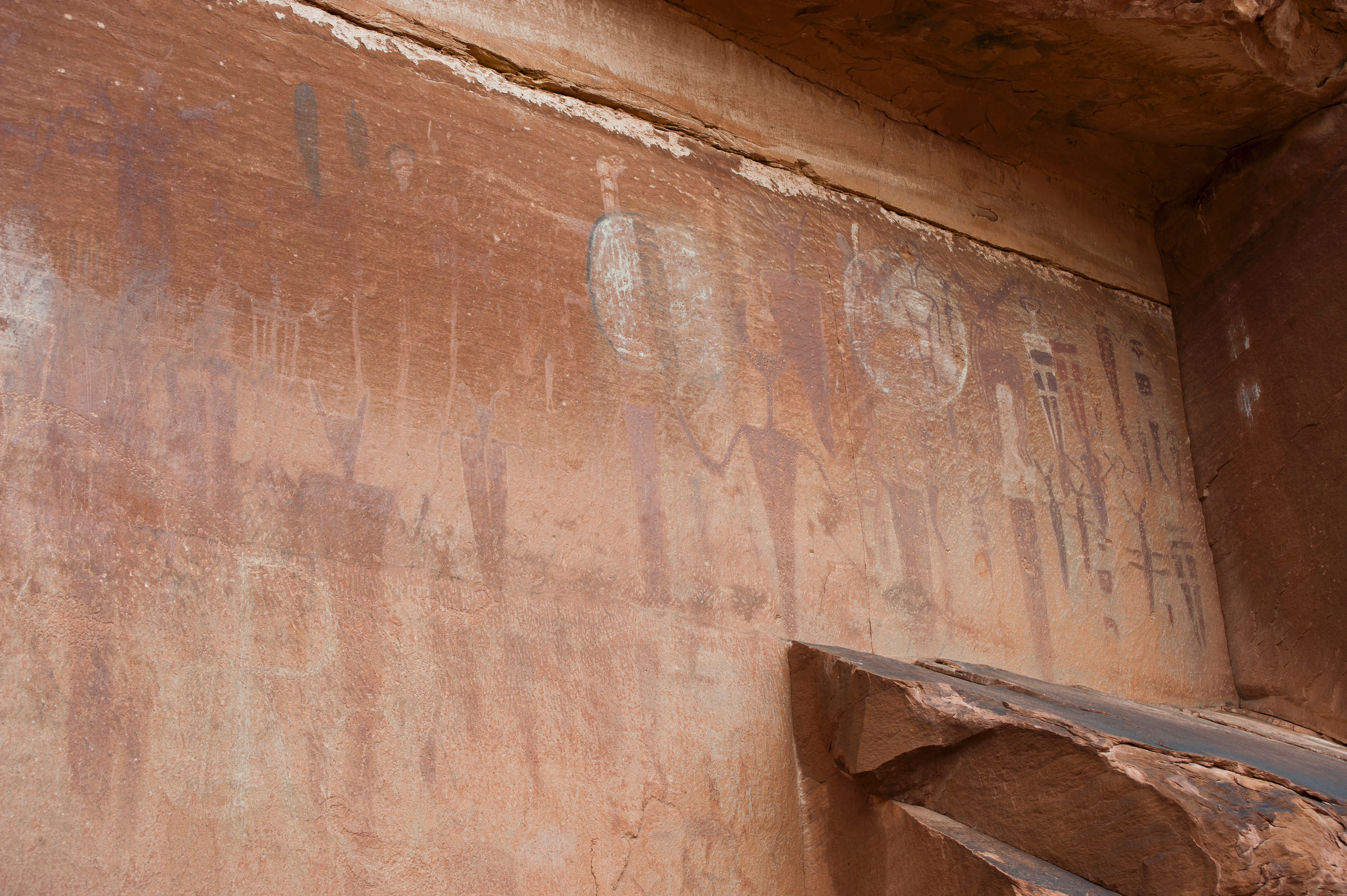
Courthouse Wash Panel Trail
~2 min drive
<p>Where Courthouse Wash joins the Colorado River, walk across the small bridge and up a short trail to see a panel of rock markings created by Indigenous travelers.</p> <ul> <li aria-setsize="-1" data-aria-level="4" data-aria-posinset="1" data-font="Symbol" data-leveltext=""…
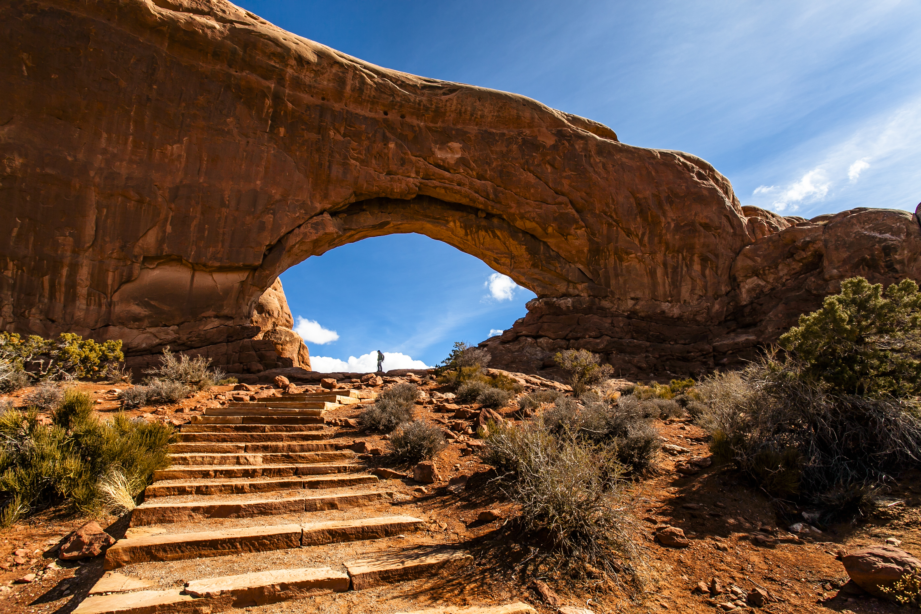
The Windows Viewpoint and Trail
~9 min drive
<p>The Windows Section is located 12 miles (19 km) from the park entrance. Massive North Window is visible from the parking lot. Trails lead to Turret Arch, North Window, South Window, and Double Arch. Limited oversize parking is available at the lower lot near Double Arch. To…
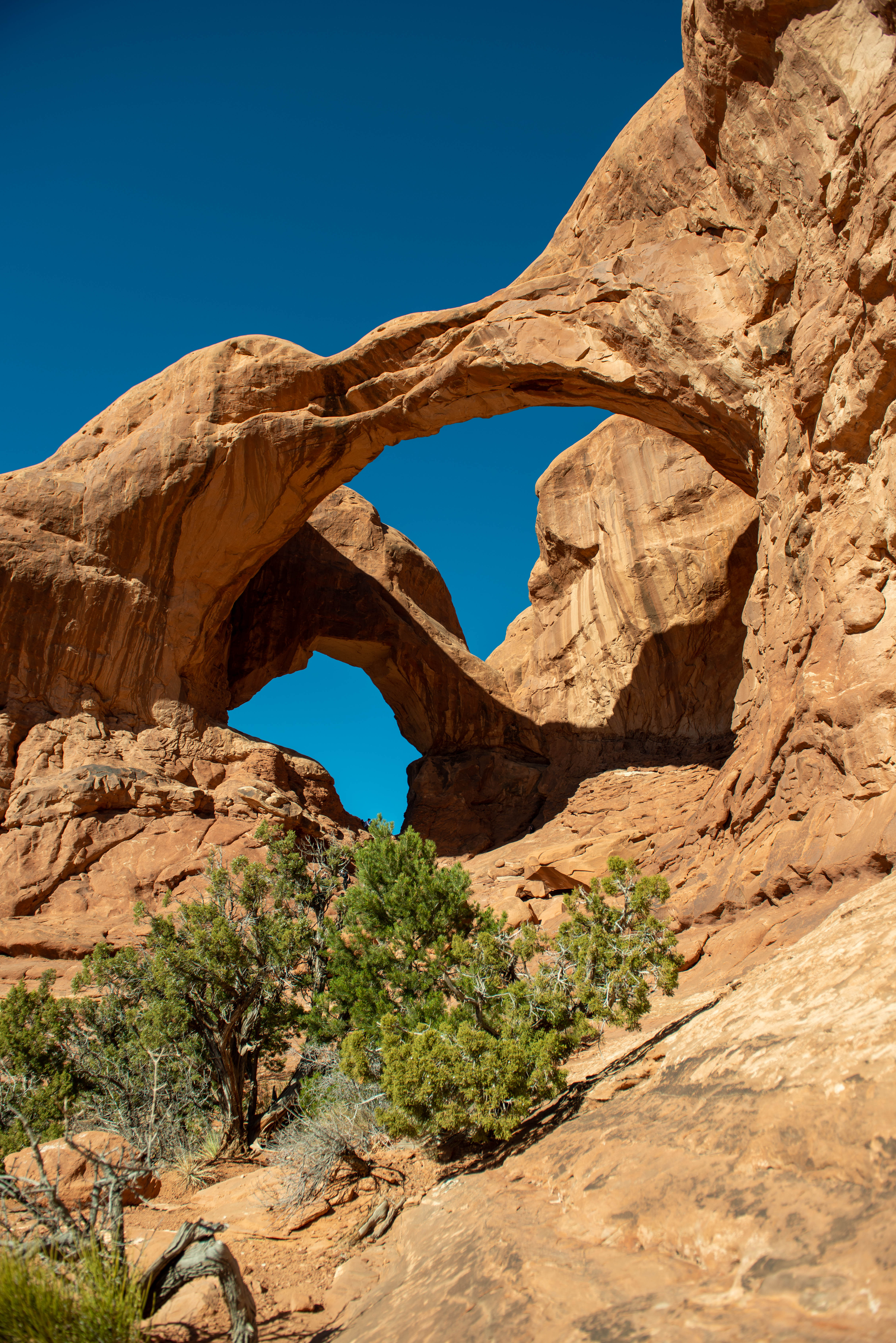
Double Arch Viewpoint and Trail
~9 min drive
<p>Visible from the parking loop at The Windows, Double Arch is an impressive feature—the <a href="https://www.nps.gov/articles/arch-rock-stars.htm">tallest </a>(112 ft/34 m) and second-longest (144 ft/44 m) arch in the park. A gently sloping path leads to its base.</p> <ul ro…
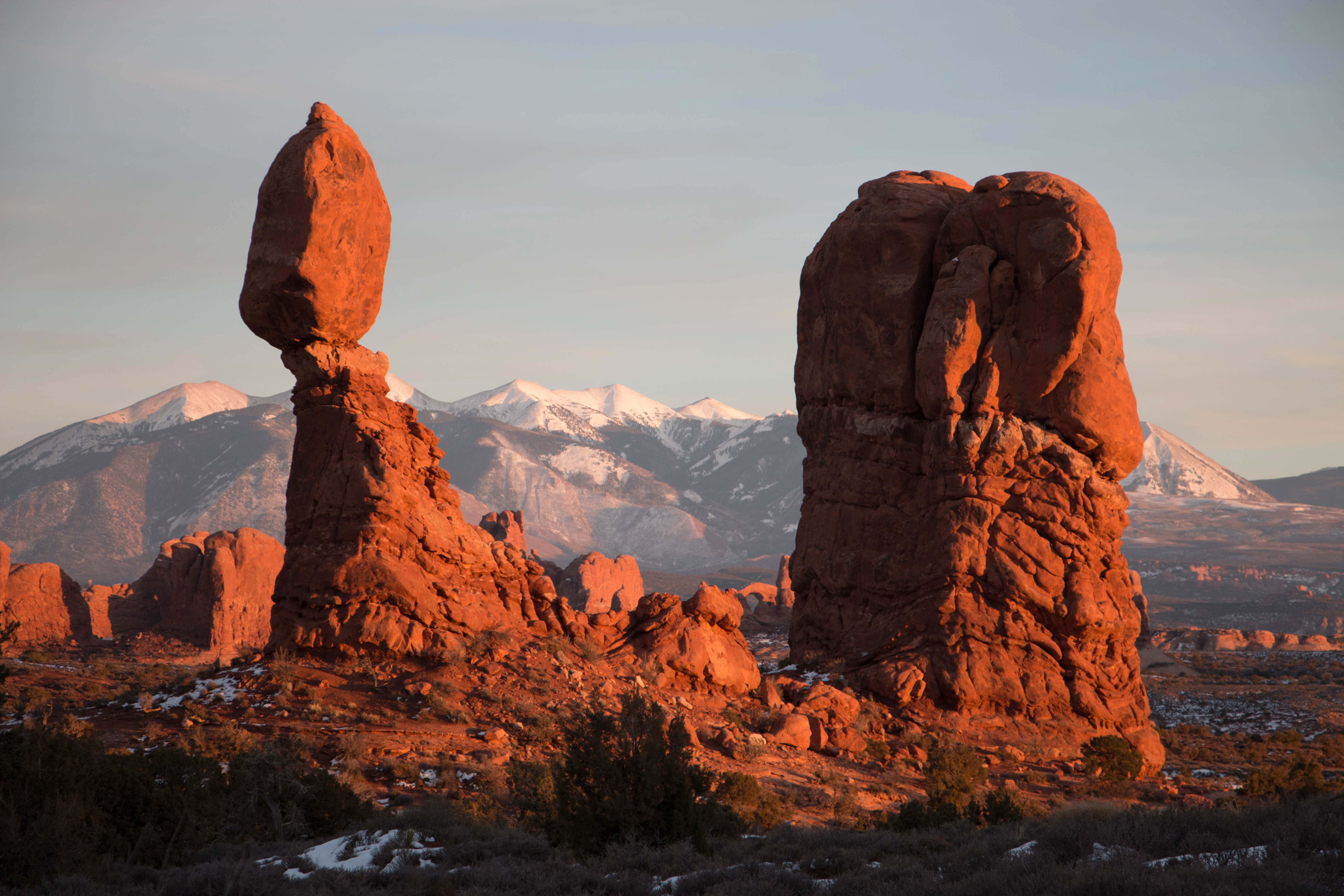
Balanced Rock Viewpoint and Trail
~10 min drive
<p>Balanced Rock can be seen from the park road 9.2 miles (14.8 km) from Arches Visitor Center. View the feature from a viewpoint or hike the short trail around it. <strong>Climbing on Balanced Rock is prohibited.</strong></p> <ul role="list"> <li paraeid="{40b1cba8-3deb-4ea9-…
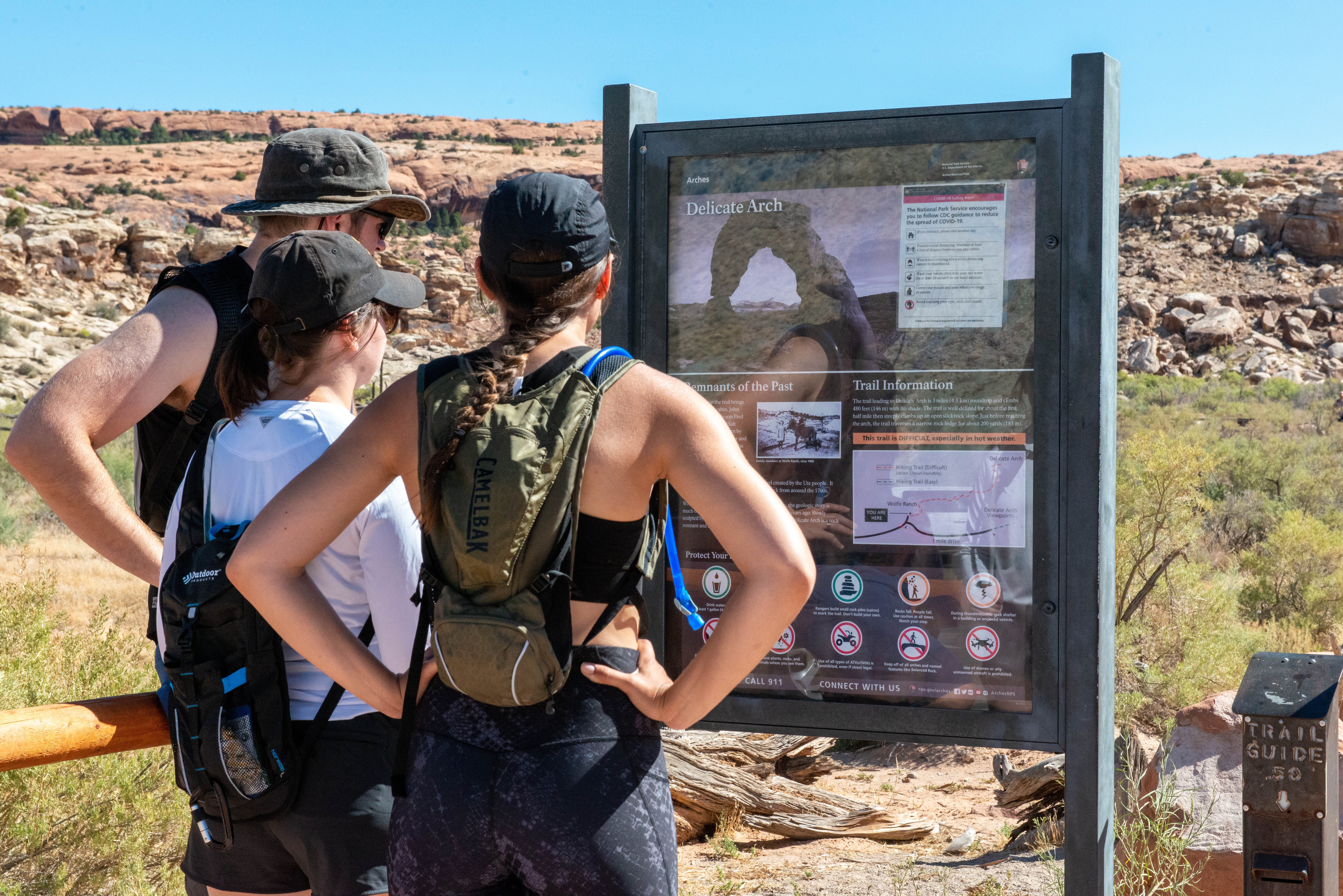
Delicate Arch Trail
~15 min drive
<p paraeid="{14474a94-72c6-4ab3-8f1d-b0b79e4a72e8}{247}" paraid="14182278"><em><strong>This trail is strenuous and the arch is not visible until the end of the trail.</strong> </em>For an easier view, try Delicate Arch Viewpoints.</p> <ul role="list"> <li p="" paraeid="{14474a…
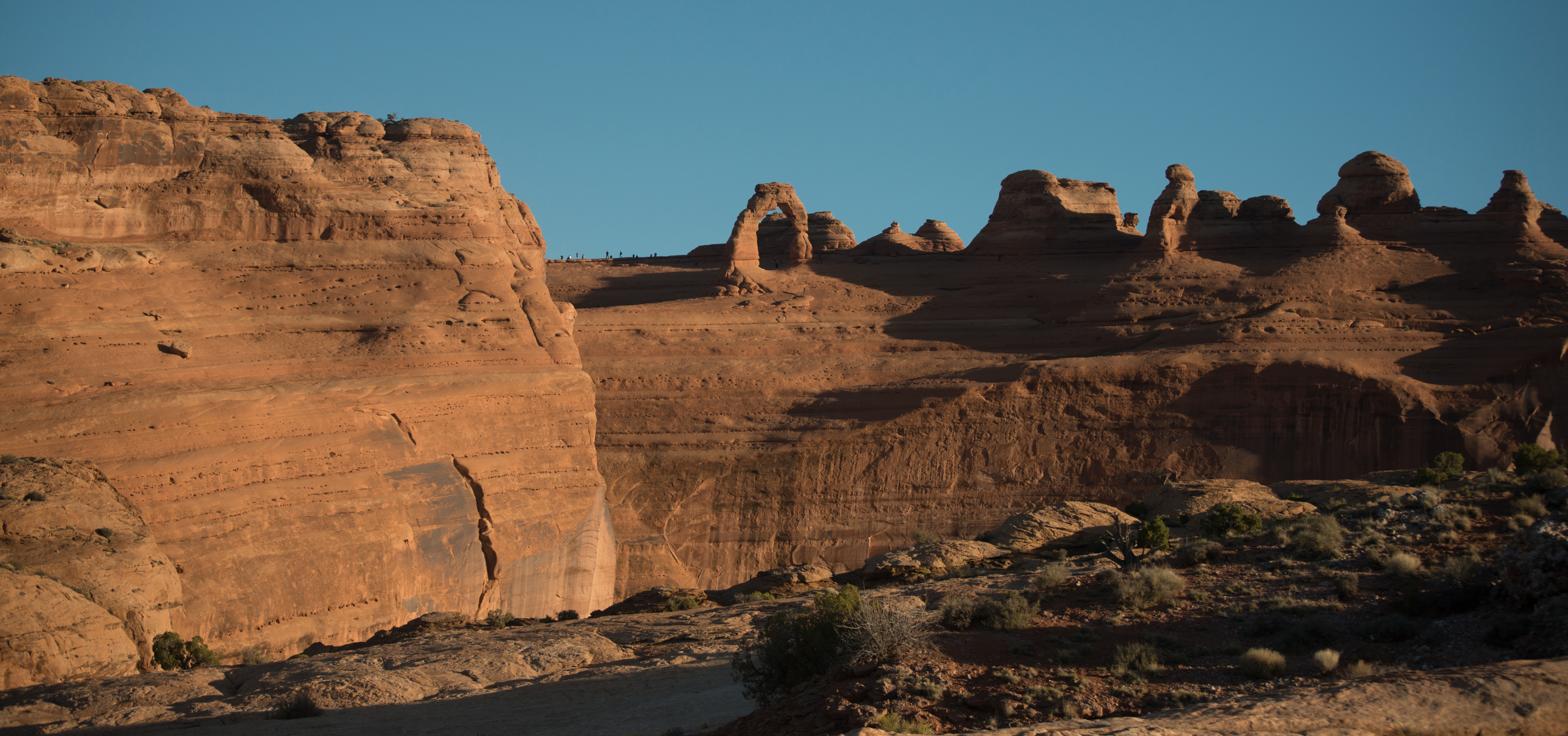
Delicate Arch Viewpoint Trails
~16 min drive
<p>Delicate Arch is the most famous arch in the park and a must-see for many visitors. View it from a distance at one of two viewpoints, both reachable from this trailhead. </p> <h4><strong>Lower Delicate Arch Viewpoint</strong></h4> <ul role="list"> <li aria-setsize="-1" data…
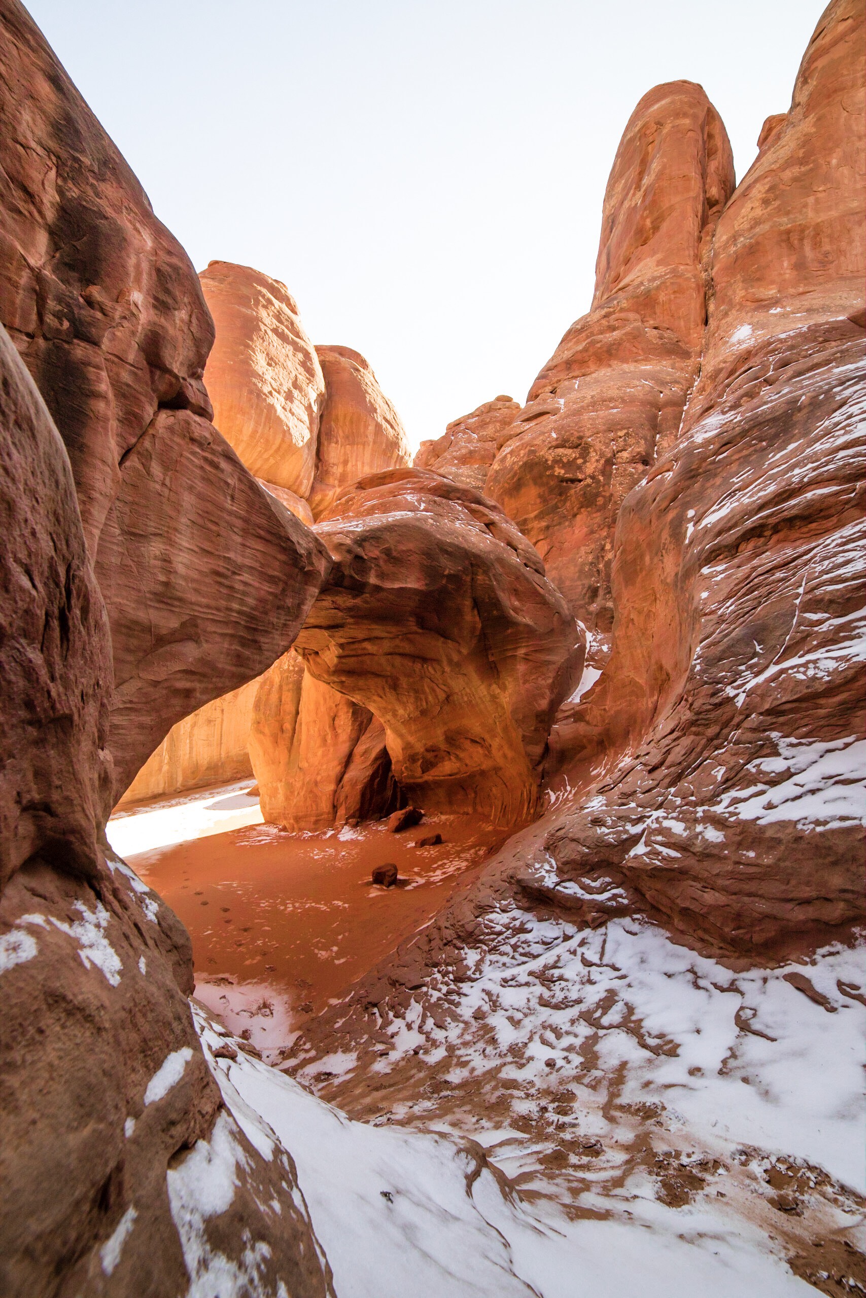
Sand Dune Arch Trail
~17 min drive
<p>Hike through deep sand to find this hidden arch between tall sandstone walls. You may also choose to continue across a grassland to Broken Arch, returning via the same trail or making a loop through the campground.</p> <h4 paraeid="{edab8278-0fbd-4351-954a-8493e494c6fe}{43}…
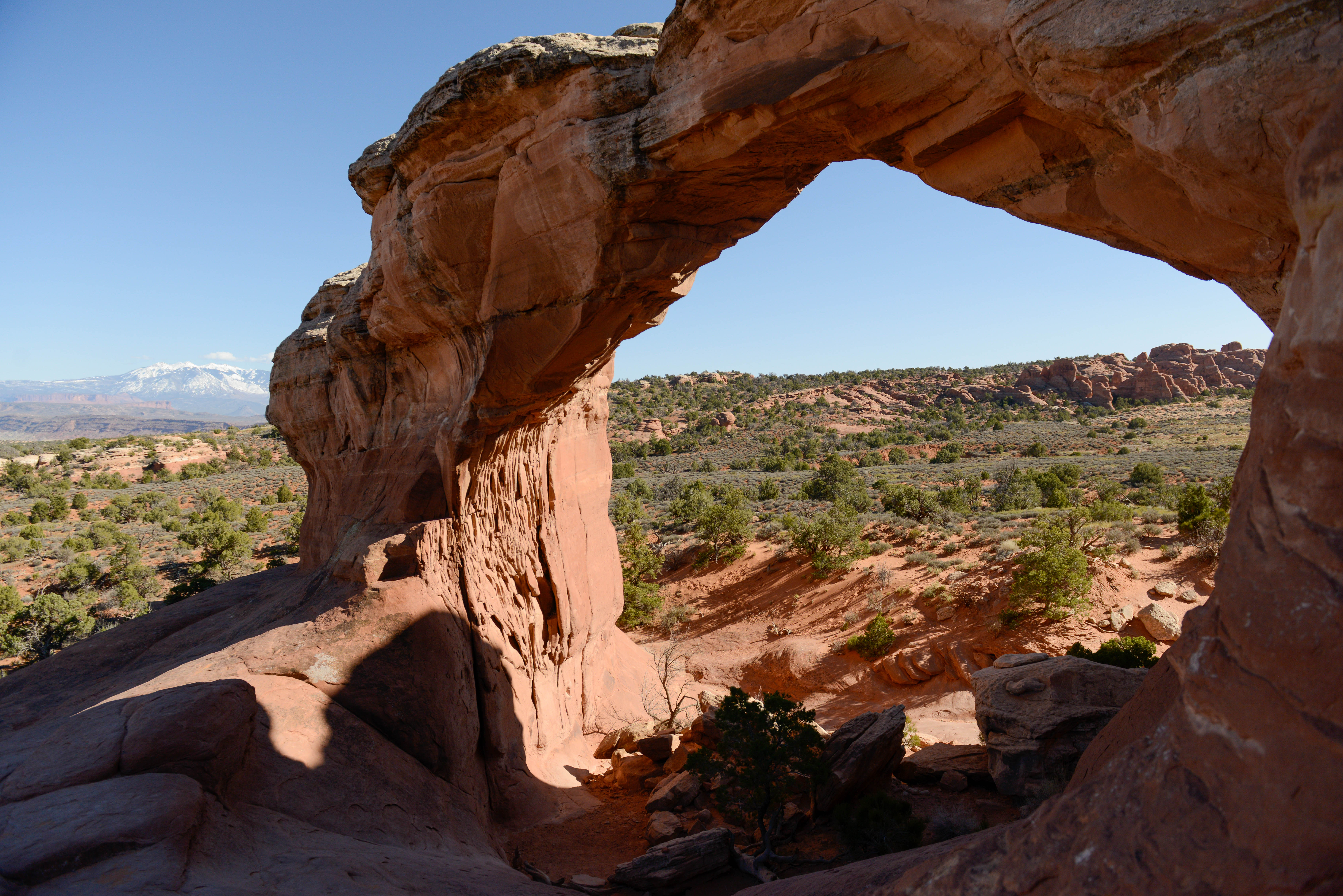
Broken Arch Trail
~17 min drive
<p>Hike across grasslands to a stone arch that isn't actually broken -- yet. You can just hike out and back to the arch, make it a loop, or add on a side trip to Sand Dune Arch.</p> <h4>Broken Arch (from Sand Dune Arch Trailhead)</h4> <ul> <li><strong>Roundtrip Distance</stron…
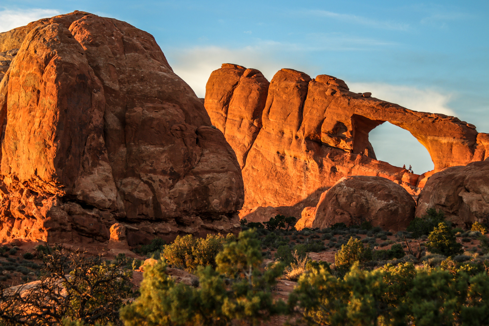
Skyline Arch Trail
~17 min drive
<p>A short, out-and-back hike on well defined trail leads to an arch in a high wall. A gentle, rocky uphill slope at the beginning of the trail continues along a relatively flat path to the base of the arch.</p> <ul role="list"> <li aria-setsize="-1" data-aria-level="4" data-a…
Local operatorsoffering guided trips. You book directly with them — Roamze doesn’t take a cut.
Up The Creek Campground
Hiking business nearby (~5 mi away) — hasn't claimed their Roamze page yet
Moab Rim Campark
Hiking business nearby (~7 mi away) — hasn't claimed their Roamze page yet
Spanish Trail RV Park
Hiking business nearby (~8 mi away) — hasn't claimed their Roamze page yet