Loading trail…

Free — you'll pick up right here.
Watch this trail
Sign up to watch it — saving subscribes you to gate, closure and report changes.
Montana
4.9 mi
Distance
230 ft
Gain
1h 44m
Time
We won't guess. Here is exactly what we do and don't know.
What we do know
Inside Custer Gallatin National Forest
2 managing-area boundaries mapped — agency alerts for them feed this page automatically.
Boundary data
What's missing
No access route mapped
We don't yet know which road reaches this trailhead, so we can't tell you if it's gated.
Nobody's filed a report here yet — be the first.
Why you'll love it
Cabin Creek Divide
AI-suggested draft · review before you go
No permit or access details on file for this trail — check with the local land manager before you go.
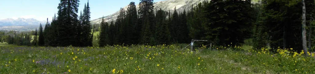
Cabin Creek Divide is a scenic 4.89-mile out-and-back trail offering modest elevation gain and accessible hiking through Montana's backcountry. This route traverses rolling terrain to a mountain divide, providing expansive views of the surrounding peaks and valleys. The gentle gradient makes it an ideal choice for hikers seeking a peaceful day hike with rewarding vistas.
Sentinel Creek
~3 min drive
Expert alpine trek with 4,776 ft gain and expansive high-country views.
Upper Sage Creek
~4 min drive
Easy 2.3-mile walk through Sage Creek with minimal elevation gain.
Lightning Lake
~4 min drive
Moderate 7.86-mile alpine lake hike with 1,960 ft elevation gain.
Dailey Creek Trailhead (WK1)
~20 min drive
This trailhead along Highway 191 in the western part of the park provides access to one trail: Dailey Creek Trail Dailey Creek Trail A strenuous 10-mile (16-km) there-and-back trail that starts near Dailey Creek and heads up to Dailey Pass, where you can reach the Sky Rim T…
Wapiti
~6 min drive
Moderate 9.44-mile Montana hike with 1,215 ft elevation gain.
Hilgard Basin
~9 min drive
Scenic alpine basin hike with steady climbing and mountain views.
Little Wapiti
~8 min drive
Moderate 8.79-mile foothills hike with 1,403 ft elevation gain.
Black Butte Trailhead (WK2)
~21 min drive
The Black Butte trailhead is on the northwest side of Yellowstone near US Highway 191. From this trailhead, you can embark on the following trail: Black Butte Trail Black Butte Trail This is a strenuous 11.4-miles (18.3 km) there-and-back trail that climbs 3,100 feet (945 m…
Red Cub
~7 min drive
Steady 15.46-mile Montana trail with moderate elevation gain and scenic backcountry views.
Avalanche Lake
~11 min drive
Scenic alpine lake hike with steady climb and mountain views.