Loading trail…

Free — you'll pick up right here.
Watch this trail
Sign up to watch it — saving subscribes you to gate, closure and report changes.
California
2.2 mi
Distance
101 ft
Gain
We won't guess. Here is exactly what we do and don't know.
What we do know
Inside Eldorado National Forest
2 managing-area boundaries mapped — agency alerts for them feed this page automatically.
Boundary data
What's missing
No access route mapped
We don't yet know which road reaches this trailhead, so we can't tell you if it's gated.
Nobody's filed a report here yet — be the first.
Why you'll love it
Mosquito Lake
AI-suggested draft · review before you go
No permit or access details on file for this trail — check with the local land manager before you go.
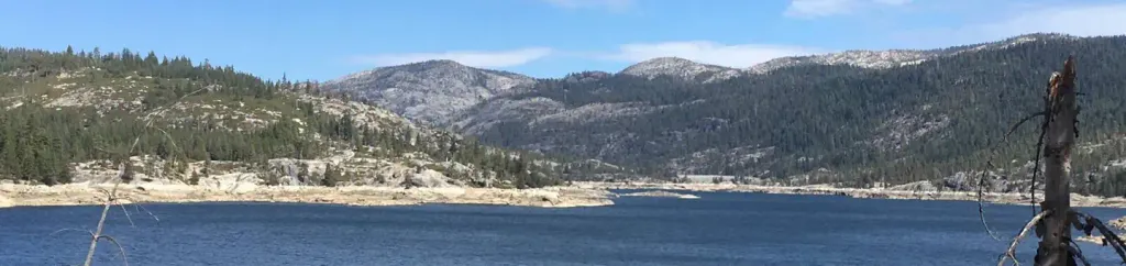
Mosquito Lake is a scenic 2.22-mile easy hike perfect for families and casual hikers seeking a quick alpine escape. With minimal elevation gain of just 101 feet, this trail offers a gentle walk to a picturesque mountain lake, ideal for picnicking, photography, or simply enjoying the serene high-country environment.
Munson Bypass
~5 min drive
Scenic 4.4-mile bypass trail with gentle climbing and peaceful forest scenery.
Long Lake
~5 min drive
Easy, scenic alpine lake hike with minimal elevation gain.
Tragedy Tie
~7 min drive
Accessible 3.4-mile trail with 422 ft elevation gain near Tragedy Tie.
Pardoes 4Wd Trail
~6 min drive
13.6-mile 4WD trail with 876 ft gain through California backcountry.
Cole Creeks Lakes
~5 min drive
Easy alpine lake hike with minimal elevation gain and scenic mountain views.
Salt Sprs. Overlook
~9 min drive
Scenic 4.27-mile overlook hike with 648 ft elevation gain and panoramic views.
Tanglefoot
~7 min drive
Moderate 7.6-mile trail with 1,647 ft gain in California backcountry.
Black Rock
~5 min drive
Easy 2.2-mile desert hike with 285 ft gain and scenic rock formations.
Granite Lake
~9 min drive
Scenic alpine lake hike with granite peaks and steady mountain views.
Camp Irene
~10 min drive
Moderate-to-hard 11.5-mile backcountry trail with substantial elevation gain.